
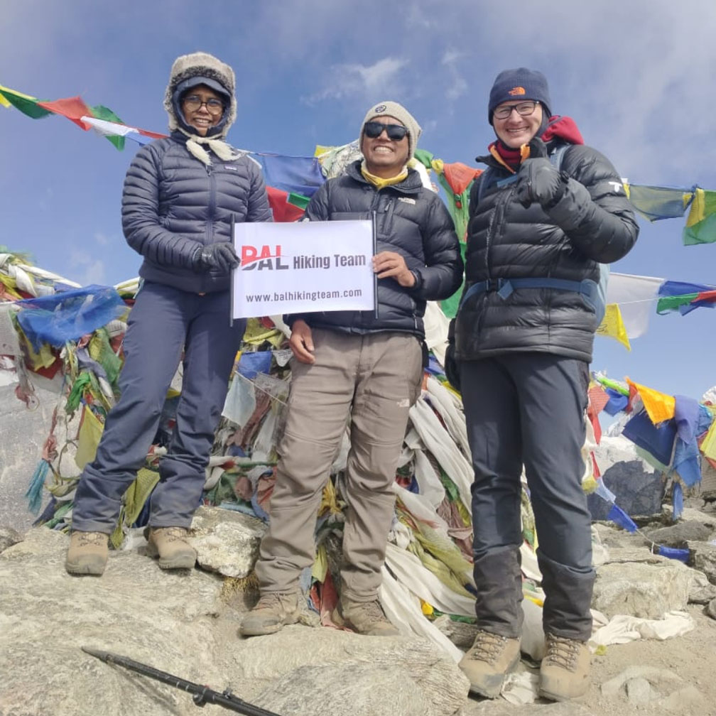
Gokyo Ri Trek
Trip Introduction
The Gokyo Ri Trek takes you through the heart of the Everest region, offering spectacular views of four turquoise Gokyo lakes, the Ngozumpa Glacier (the largest glacier in Nepal), and panoramic vistas from Gokyo Ri (5,357 m). Unlike the classic Everest Base Camp route, this trek visits the hidden Gokyo valley, with relatively fewer crowds. Completing the Gokyo Ri trek is immensely rewarding—stunning alpine lakes, fewer crowds than the classic EBC route, and unparalleled mountain panoramas from Gokyo Ri. By following the suggested acclimatization schedule, carrying proper gear, and trekking at a comfortable pace, you’ll maximize your safety and enjoyment. Safe travels and enjoy every moment in the Khumbu!
Gokyo Ri Trek Package Cost
- Standard 12-Days Package Cost: $1,400 per person.
ncludes:
 Domestic flights (Kathmandu–Lukla round trip),
during the trek, full board meals lunch dinner breakfast ,Tea, Coffee.
All permits, guide and porter services, 1 porter between 2 trekkers .
Bal Hiking Team Duffel Bag, you have to be rerun after trekking
Trekking Certificates,
Staffs first aid kid,
Seasonal fresh fruits and Biscuits etc.
Down jacket and sleeping bag during the trek, if you required
Airport transfers, airport pick up and drop.
Fingertip pulse oximeter (we use every day to check your oxygen level and pulse in your body to avoid high risk.)
13% Government Vat and official expenses.
Best available Room and Lodge during the treks.
Excludes;
 International flights,
Hotel in Kathmandu,
Nepal visa, Travel insurance,
Water, Wifi, hot Shower, Helicopter, Trekking Equipment,
Guide /Porter Tips and personal expenses.
Gokyo Ri Trek Itinerary (11 Nights / 12 Days)
Day 1: Arrival in Kathmandu 1350m. You will pick up by Bal Hiking Team Agency and drive to your Hotel
Day 2: Kathmandu (1,350 m) → Lukla (2,800 m) → Phakding (2,610 m)
- Very Early Morning (04:30–05:00):
- Transfer from your hotel in Kathmandu to Kathmandu Domestic Airport (Jr. R.Tair airport) for the 06:00 AM (approx.) flight to Lukla.
- Flight time: ~35 minutes (10 min taxi to runway + 25 min flying).
- Upon Landing in Lukla (2,800 m):
- Brief stop to have tea/coffee and stretch.
- Begin descent along the Dudh Koshi River to Phakding.
- Trek Details:
- Distance: ~8 km (Lukla → Phakding)
- Elevation Change: –190 m descent overall (2,800 m→2,610 m), with small ups/downs.
- Time: 3–4 hours of easy–moderate trekking.
- Highlights:
- Crossing several suspension bridges (Tenzing & Hillary Bridge).
- Forested trails along Dudh Koshi River, glimpses of Kusum Kanguru (6,367 m).
- Accommodation in Phakding:
- Lodge (tea‑house), basic twin/shared rooms, communal bathroom.
- Hot meals available (dal bhat, soup, pasta).
Day 3: Phakding (2,610 m) → Namche Bazaar (3,440 m)
- Trek Details:
- Distance: ~10 km
- Elevation Gain: ~830 m (2,610 m→3,440 m)
- Time: 5–6 hours (including breaks, photo stops).
- Route:
-
- Phakding → Monjo (2,835 m) (~2–3 hrs)
- Check TIMS, Sagarmatha NP permits at Monjo checkpoint.
- Monjo → Jorsale (2,740 m) (~30 min)
- Village with a few lodges, last chance for snacks.
- Jorsale → Namche Bazaar (3,440 m) (~2–3 hrs)
- Five large suspension bridges over Dudh Koshi and Bhote Koshi.
- Final steep zig-zag ascent (~500 m) into Namche.
- Phakding → Monjo (2,835 m) (~2–3 hrs)
- Highlights:
-
- First panoramic view of Everest (8,848 m), Lhotse (8,516 m), Nuptse (7,861 m) from above Jorsale.
- Sherpa Culture: tea‑houses, bakeries, internet cafés in Namche.
- Accommodation in Namche:
- Mid‑range lodges (e.g., Khumbu Resort).
- Shop for any missing gear, fresh produce.
Day 4: Acclimatization & Exploration in Namche Bazaar (3,440 m)
- Purpose: Proper acclimatization to avoid Acute Mountain Sickness (AMS).
- Suggested Morning Hike:
- Namche Bazaar → Everest View Hotel (3,962 m) → Syangboche Airstrip (~3,780 m) → Namche
- Distance: ~6 km round trip.
- Elevation Gain: ~520 m (to Everest View); moderate trail.
- Time: 4–5 hours including breaks.
- Namche Bazaar → Everest View Hotel (3,962 m) → Syangboche Airstrip (~3,780 m) → Namche
- Highlights:
- Everest View Hotel Terrace: Unobstructed vistas of Everest, Lhotse, Ama Dablam (6,812 m).
- Syangboche Airstrip: A tiny, one‑plane airstrip perched on a ridge (3,780 m).
- Visit the Sherpa Museum in Namche (entry ~NPR 200).
- Afternoon & Evening:
- Return to Namche, rest, hydrate, and enjoy local bakeries (momos, pizzas).
- Attend a short Sherpa culture performance (if available).
- Accommodation:
- At Lodge
Day 5: Namche Bazaar (3,440 m) → Dole (4,110 m)
- Trek Details:
- Distance: ~8 km
- Elevation Gain: ~670 m (3,440 m→4,110 m)
- Time: 5–6 hours
- Route & Terrain:
-
- Namche → Phortse Thanga (3,500 m) (~1–1.5 hrs)
- Gradual ascending trail through forest.
- Phortse Thanga → Mong La (3,950 m) (~2 hrs)
- Open trails with views of Kangtega (6,782 m).
- Mong La → Dole (4,110 m) (~1.5 hrs)
- Final push with some switchbacks; sparse vegetation near Dole.
- Namche → Phortse Thanga (3,500 m) (~1–1.5 hrs)
- Highlights:
-
- Views of Ama Dablam, Thamserku (6,608 m), Taboche (6,542 m).
- Dole village: quaint teahouses, mountain views.
- Accommodation in Dole:
- Basic tea‑houses, twin/shared rooms
- Meals: dal bhat, thukpa, noodle soup etc
Day 6: Dole (4,110 m) → Machhermo (4,470 m)
- Trek Details:
- Distance: ~6 km
- Elevation Gain: ~360 m (4,110 m→4,470 m)
- Time: 4–5 hours
- Route & Terrain:
-
- Dole → Lungden (4,380 m) (~2 hrs)
- Rocky trail, occasional moraines.
- Lungden → Machhermo (4,470 m) (~1.5 hrs)
- Gentle ascent past yak pastures.
- Dole → Lungden (4,380 m) (~2 hrs)
- Highlights:
-
- Walking alongside the Ngozumpa Glacier (visible from halfway).
- Panoramic view from Machhermo of Cho Oyu (8,201 m), Taboche, Cholatse (6,440 m).
- Accommodation in Machhermo:
- Slightly more developed tea‑houses; hot showers (extra cost).
- Souvenir shops selling local crafts.
Day 7: Machhermo (4,470 m) → Gokyo (4,800 m)
- Trek Details:
- Distance: ~7 km
- Elevation Gain: ~330 m (4,470 m→4,800 m)
- Time: 4–5 hours
- Route & Terrain:
-
- Machhermo → Ngele Labrang (4,540 m) (~1 hr)
- Close-up views of Cho Oyu’s ice-face.
- Ngele Labrang → Gokyo (4,800 m) (~3 hrs)
- Traverse moraine ridges, passing Third and Fourth Lakes.
- Machhermo → Ngele Labrang (4,540 m) (~1 hr)
- Highlights:
-
- Gokyo Village: Sherpa settlement at the foot of Gokyo Ri.
- Three/Above Lakes:
- First Lake (Dudh Pokhari, 4,700 m) – emerald color, often frozen in late season.
- Second Lake (Thonak Cho, 4,850 m) – slightly larger.
- Third Lake (Ngozumpa Tsho, 4,900 m) – deep turquoise, massive.
- Fourth Lake (Taboche Tsho, 5,200 m) – further north (optional side hike).
- Accommodation in Gokyo:
- Tea‑houses built into the hillside (heated common rooms with wood‑burning stoves).
- Dorm-style rooms (multiple people) or small private rooms (vary by lodge).
- Note: fewer amenities; electricity via solar/petrol generator (6 hours/day).
Day 8: Acclimatization & Gokyo Ri Summit (5,357 m) → Gokyo (4,800 m)
- Pre‑dawn Start (03:00–04:00):
- Trek up to Gokyo Ri viewpoint for sunrise.
- Distance (one‐way): ~1.6 km from Gokyo village.
- Elevation Gain: ~557 m (4,800 m→5,357 m).
- Time (round‑trip): 4–5 hours including summit time.
- Summit Views:
- North/East: Cho Oyu (8,201 m).
- South: Mount Everest (8,848 m), Makalu (8,463 m), Lhotse (8,516 m), Nuptse (7,861 m).
- West: Thamserku (6,608 m), Ama Dablam (6,812 m), Pumori (7,161 m).
- Spectacular sea of Himalayan peaks at sunrise.
- Afternoon (Optional Excursion):
- Hike to Fourth Lake (Taboche Tsho, 5,200 m): ~3 hours round‑trip.
- Terrain: moraine ridges, glacial streams.
- Hike to Fourth Lake (Taboche Tsho, 5,200 m): ~3 hours round‑trip.
- Return to Gokyo:
- Descend to the same lodge; rest and hydrate.
- Accommodation in Gokyo:
- At Lodge
Day 9: Gokyo (4,800 m) → Machhermo (4,470 m)
- Trek Details:
- Distance: ~10 km (via same route down)
- Elevation Loss: ~330 m (4,800 m→4,470 m)
- Time: 5–6 hours
- Route:
- Descend past Ngele Labrang → Machhermo.
- Highlights:
- Leisurely downhill; time to take in glacier vistas.
- Spot for yak herders and local wildlife (Himalayan marmots, snow partridge).
- Accommodation in Machhermo:
- At Lodge
Day 10: Machhermo (4,470 m) → Namche Bazaar (3,440 m)
- Trek Details:
- Distance: ~16 km (Machhermo → Dole → Phortse Thanga → Namche)
- Elevation Loss: ~1,030 m (4,470 m→3,440 m)
- Time: 6–7 hours (long day, broken by lunch in Phortse Thanga)
- Route:
-
- Machhermo → Dole (~2 hrs)
- Dole → Phortse Thanga (~2 hrs)
- Phortse Thanga → Namche (~2.5 hrs)
- Highlights:
-
- Easier downhill slopes; chance to revisit viewpoints (Kangtega, Ama Dablam).
- Final approach to Namche: re-enter bustling Sherpa hub.
- Accommodation in Namche:
- Choose a slightly different lodge if you wish (e.g., for better views/amenities).
Day 11: Namche Bazaar (3,440 m) → Lukla (2,800 m)
- Trek Details:
- Distance: ~20 km (via Monjo & Phakding)
- Elevation Loss: ~640 m (3,440 m→2,800 m)
- Time: 7–8 hours (longest trekking day; start early)
- Route:
-
- Namche → Phakding (~5–6 hrs, passing Monjo, Jorsale)
- Phakding → Lukla (~2 hrs)
- Highlights:
-
- Final chance to view Everest peaks as they recede behind you.
- Many tea‑houses along the way for lunch or tea.
- Accommodation in Lukla:
- Lodge in Lukla. Celebrate final evening: yak steak or noodle soup.
Day 12: Lukla (2,800 m) → Kathmandu (1,350 m)
- Very Early Morning (06:00):
- Fly from Lukla back to Kathmandu (weather permitting).
- Typical flight time: ~35 minutes.
- Rest of Day:
- Return to your hotel in Kathmandu.
- Relax, enjoy a shower, and explore Thamel for shopping and a celebratory dinner.
- If Flight Canceled:
- Have a contingency day in Lukla; use it for final gear adjustments, short hikes around Lukla (Hillary School viewpoint at Chaunrikharka, ~3,400 m).
Note: At list 2 days extra requires in case of Lukla to Kathmandu flight cancellation due the Bad Weather.
- Altitude & Acclimatization Notes
- Acute Mountain Sickness (AMS) Risks
- Above 2,500 m, especially past 3,000 m.
- Common symptoms: headache, nausea, dizziness, fatigue, insomnia.
- Acclimatization Strategy
- “Climb High, Sleep Low”: Day hikes from Namche, Machhermo, and Gokyo.
- Stay hydrated: ≥3 L/day of fluids.
- Avoid alcohol and sedatives.
- If you develop moderate AMS (persistent headache, nausea, shortness of breath at rest), consider descending immediately.
- Carry Diamox (Acetazolamide) as prescribed (125 mg × 2/day), starting Day 2; consult a physician before departure.
- Key Highlights & Photo Opportunities
- Lukla’s Rugged Airstrip: Dramatic takeoff/landing.
- Namche Bazaar: Bustling Sherpa center, colorful shops, bakery treats.
- Everest View Hotel (3,962 m): Panoramic sunrise views.
- Ama Dablam Vista Points: Between Namche and Dole; prime photography spot.
- Ngozumpa Glacier: Largest valley glacier in the Himalayas (visible from Machhermo).
- Gokyo Lakes (4,700 m–5,200 m): Vibrant glacial lakes; reflect emerald‑blue waters.
- Gokyo Ri Summit (5,357 m): Grand 360° vista of Everest, Lhotse, Makalu, Cho Oyu.
- Tips for a Smooth Trek
- Book Early: Lukla flights fill up quickly during peak season (Sept–Nov, Mar–May).
- Cash & Banking: ATMs in Kathmandu; none on the trail. Carry sufficient NPR (Nepalese Rupees).
- Hydration: Refill water at tea‑houses (filtered) or use purification tablets.
- Electricity: Limited solar power in higher villages; carry extra power bank.
- Cold & Hypoxia: Nights get very cold (–10 °C to –15 °C). Ensure your sleeping bag is rated accordingly.
- Etiquette:
- Ask before photographing locals (especially Sherpa women).
- Single-use plastics: discouraged—carry trash down to Namche for proper disposal.
- Insurance: Must include high-altitude evacuation (≥ 5,500 m coverage). Helicopter rescue can cost ≥ $3,000.
- Guides vs. Independent Trekking:
- Independent: More freedom, cost‑effective if experienced; must self-navigate and carry all permits.
- Trekking Agency/Guide: Simplifies permits, accommodations, offers local knowledge, and better acclimatization monitoring.
- Sagarmatha National Park Entry Permit
- Cost: NPR 3,000 for foreigners (valid for multiple entries).
- Issued in Monjo (on the trail) or in Kathmandu.
- Kakani Checkpoint/Khumbu Pasang Lhamu Rural Municipality Permit
- Cost: NPR 2,000 (issued at Monjo on the trail).
- Booking Flights & Accommodations
- Kathmandu–Lukla (Tenzing-Hillary Airport) round‑trip flight: book in advance, especially during peak seasons.
- Tea-house lodges from Phakding to Gokyo are available but basic (shared rooms, attached or shared bathrooms).
- Best Season
- Autumn (Late September to November)
- Clear skies, stable weather.
- Daytime temperatures: 5 °C–15 °C (at Namche, lower nights).
- Trails moderately busy (peak late October).
- Spring (March to May)
- Rhododendron blooms, moderate crowds.
- Daytime temperatures: 5 °C–12 °C (at Namche).
- Good visibility, but occasional pre-monsoon showers in lower elevations.
- Physical Preparation & Packing Highlights
- Physical Fitness:
- Aim for 2–3 months of cardio (jogging, stair climbing) + leg-strength workouts.
- Practice day hikes with a 10–13 kg backpack.
- Essential Gear (approximate):
- Trekking boots (broken-in, waterproof).
- 4-season sleeping bag (rated to –10 °C to –15 °C).
- Down jacket (to –20 °C).
- Fleece mid‑layer, thermal base layers.
- Trekking poles (strongly recommended for ascents/descents).
- Headlamp, sunglasses (UV protection), sunscreen (SPF 50+), lip balm.
- Water purification (filter or tablets).
- First‑aid kit (including altitude‑specific meds: Acetazolamide, Diamox).
- Reusable water bottles (1–1.5 L) + insulated cover for cold.
- Dry bags/zip-locks (for electronics and clothes).
Clothing
- Base Layers (Next-to-skin)
- 2–3 moisture-wicking, quick-dry long-sleeve tops (e.g., merino wool or synthetic)
- 2–3 moisture-wicking, quick-dry long underwear bottoms
- Insulating Layers
- 1 lightweight fleece jacket (midweight, 200–250 gsm)
- 1 down or synthetic insulated jacket (ideally 600+ fill down; for evenings and high‑altitude sides)
- 1 pair of fleece or insulated pants (for camp and cold mornings/evenings)
- Shell Layers (Wind/Water Protection)
- 1 waterproof/breathable rain jacket (e.g., 3‑layer hardshell or robust 2.5‑layer) with hood
- 1 waterproof/breathable rain pants
- Mid‑Layers & Extras
- 1 lightweight softshell or light windbreaker (optional but helpful for layering during active trekking days)
- 1 down vest or light synthetic vest (optional for layering around camp)
- Trekking Shirts & Pants
- 2–3 hiking T‑shirts (preferably quick‑dry, synthetic or merino wool)
- 1–2 pairs of convertible trekking pants (zip‑off pant → shorts)
- 1 pair of trekking shorts (optional, but nice for lower elevations or sunny days)
- Underwear & Socks
- 4–5 pairs of moisture‑wicking underwear (avoid cotton)
- 4–5 pairs of trekking socks (merino wool blend; mid‑weight)
- 1 pair of lightweight liner socks (optional, helps防blisters)
- Head & Hands
- 1 warm beanie (fleece or wool)
- 1 sun hat or baseball cap (with brim for sun protection)
- 1 buff or neck gaiter (for dust/cold)
- 1 pair of lightweight liner gloves (for early‑morning use)
- 1 pair of insulated, waterproof gloves or mittens (for summit morning; Gore‑Tex or similar)
Footwear
- Trekking Boots
- 1 pair of mid‑ or high‑cut, waterproof, broken‑in trekking boots (ankle support is crucial above 4,000 m)
- Camp Shoes
- 1 pair of lightweight, closed‑toe camp shoes (e.g., sandals with heel strap or slip‑on hikers)
- Optional Add‑Ons
- 1 pair of gaiters (lightweight trail gaiters to keep out snow/dust)
- Microspikes or light crampons (depending on season—if early spring/late autumn there may be icy patches above Namche)
Backpack & Day‑Pack
- Trekking Backpack
- 50 – 60 L capacity (to carry clothing, sleeping bag, down jacket, camera, etc.; porter will usually carry this, but you need to fit everything inside)
- Rain cover (ideally integrated or separate)
- Daypack
- 20 – 25 L daypack (for daily essentials: water bottles, camera, sunscreen, snacks)
- Foam or inflatable sit pad (some teahouses don’t have chairs; helps with insulation from cold benches)
Sleeping & Camp Gear
(If you prefer to carry your own; otherwise can often rent/hire locally, but quality varies.)
- Sleeping Bag
- Minimum – 20 °F / –7 °C rating (preferably down; at Gokyo base (~4,700 m) nighttime temps can drop to around –10 °C in spring/ autumn)
- Down alternatives are acceptable but should compress well and be lightweight
- Sleeping Bag Liner
- Silk or thermal liner (adds 5–10 °F warmth, keeps bag clean; Teahouse sleeping bags may be questionable)
- Sleeping Pad (Inflatable or Foam)
- Closed‑cell foam pad or inflatable pad with insulation (R‑value ≥ 3) to insulate from cold floors
Trekking & Technical Gear
- Trekking Poles
- Adjustable, collapsible poles with comfortable foam or cork grips
- Rubber tips and optional snow baskets (for early season)
- Headlamp
- High‑output LED headlamp (≥ 200 lumens) plus extra batteries or rechargeable headlamp with charging cable/power bank
- Sunglasses & Eyewear
- 100 % UV‑protected sunglasses (Category 3 or 4 lenses; glacier glasses recommended above 5,000 m)
- Prescription glasses/contact lenses plus backup (if needed)
- Water Bottles & Hydration
- 2 × 1 L wide‑mouth BPA‑free water bottles or 1 × 2 L hydration bladder plus 1 × 1 L bottle
- Insulated bottle sleeves (to prevent freezing above 4,000 m)
- Water Treatment
- Water purification tablets (e.g., Aquatabs) or water filter/purifier (e.g., Sawyer Mini, SteriPEN)
- Chlorine Dioxide tablets or iodine tablets (if you prefer chemical treatment)
- Trekking Gaiters
- Lightweight trail gaiters (to keep out dust/snow below Gokyo or at Ngozumba Glacier area)
- Trekking Gloves
- Lightweight liner gloves
- Insulated gloves (waterproof) for summit morning
Personal & Toiletries
- First‑Aid & Medications
- Personal medications (prescription, altitude-related if any, e.g., Diamox—consult physician)
- Blister kit: moleskin, Compeed patches, antiseptic wipes, antibiotic ointment
- Pain relievers (ibuprofen/acetaminophen), electrolyte packets, diarrhea medication (e.g., loperamide), antihistamines, antihistamine cream (for insect bites)
- Basic first-aid kit: band‑aids, gauze pads, medical tape, disinfectant wipes, antiseptic solution
- Sunscreen (SPF 50+; strong UVA/UVB protection) and lip balm with SPF
- Insect repellent (DEET‑based or picaridin) for lower altitudes
- Toiletries
- Biodegradable wet wipes (used for “bucket baths” in teahouses)
- Toothbrush, toothpaste (travel‑size)
- Travel towel (quick‑dry microfiber; small pack towel)
- Hand sanitizer (≥ 70 % alcohol)
- Shampoo/body wash (biodegradable, small travel bottles)
- Toilet paper (most teahouses have limited supply—pack 1–2 rolls in small plastic bag)
- Personal Hygiene & Comfort
- Hand/body wipes, small pack of tissues (for pit stops)
- Small zip‑lock bags (for wet or dirty items; to separate electronics from moisture)
- Feminine hygiene products (if applicable; facilities are very basic—pack out used items in sealed bags)
Navigation & Communication
- Maps & Guidebooks
- Detailed topographic map of the Everest region (e.g., Himalayan Maphouse) or laminated trail map
- Everest region trekking guidebook (for reference in teahouses)
- Compass / GPS Device (optional; many trekkers rely on guide/porter but good for backup)
- Mobile Phone & SIM Card
- Unlocked smartphone (Vodafone, Ncell, or SmartCell SIM cards work in most teahouses up to Namche/Phortse)
- Portable charger or power bank (≥ 10,000 mAh)
- Solar charger (optional; but many teahouses charge ~USD 1 per hour for electronics)
- Emergency Communication
- Satellite messenger device or personal locator beacon (optional but recommended above 4,500 m)
- Whistle (3‑pole safety whistle for altitude emergencies)
Electronics & Photography
- Camera & Accessories
- Mirrorless or DSLR camera (if desired) plus spare batteries (batteries drain faster in cold)
- Memory cards (32 GB or higher; bring extras)
- Lightweight tripod (mini/travel size; for sunrise/sunset shots at Gokyo Ri)
- Charging & Power
- Universal travel adapter (Nepal uses 230 V, 50 Hz; sockets: C, D, M types)
- Power strip (optional; if sharing charge ports with your trekking partner)
- Headlamp (already mentioned under technical gear)
Food, Snacks & Nutrition
- High‑Energy Snacks
- Trail mix, nuts, energy bars (e.g., Clif Bars, Trek Bars), chocolate, dried fruit
- Electrolyte powder packets (mix into water)
- Optional Extras
- Instant coffee or tea bags (most teahouses sell tea, but personal favorite blend is nice)
- Instant soups (e.g., ramen, noodles) for quick, warm calories above Namche when meals are limited
Documents & Money
- Permits & Paperwork
- Khumbu Pasang Lhamu Municipality Permit NPR 2000.
- Sagarmatha National Park Entry Permit (approx. NPR 3,000; get in Kathmandu or Monjo checkpoint)
- Photocopies of passport main page, visa page, and two passport‑size photos (carried separately from originals)
- ATM
- ATM available in Lukla and Namche Bazaar)
Miscellaneous & Comfort Items
- Trekking Permits Holder (neck pouch or waist pouch to keep permits/passport secure)
- Dry Bags / Ziploc Bags (to keep electronics/clothes dry during rain/snow)
- Duct Tape / Repair Kit (small roll of duct tape wrapped around water bottle; repair patches for sleeping pad; multi‑tool)
- Notebook & Pen (for journaling, leaving notes for other trekkers, or keeping expense log)
- Earplugs & Eye Mask (teahouse dorms can be noisy and have early‑morning light)
- Small Stuff Sack Organization (to separate socks, underwear, toiletries in backpack)
- Trekking Permits Holder (waterproof pouch to keep TIMS and Sagarmatha permit safe)
- Trail Snacks & Gum (peppermint gum for appetite, energy boost during steep climbs)
Season‑Specific Considerations
- Spring (March–May)
- Nights still quite cold at Gokyo/Gokyo Ri (~‐5 °C to –10 °C). Insulated jacket and warm sleeping bag are mandatory.
- Possible snow/drizzle during March–April, so waterproof shell and gaiters recommended.
- Autumn (September–November)
- Stable, dry weather, but nights drop sharply below freezing above 4,000 m. Insulation layers are essential.
- Snow can start mid‑November; microspikes helpful if trekking late November.
- Winter (December–February) (Not recommended unless very experienced)
- Daytime highs around –5 °C at Gokyo; nights plunge to –20 °C. Ultra‑warm down jacket (800 fill+), crampons, heavy‑duty boots, expedition gloves, and high‑altitude sleeping bags (–20 °C) required.
- Summer/Monsoon (June–August)
- Heavy rain, landslide risk, leeches and mosquitoes below Namche. Waterproof everything (bag covers, rain gear). Consider postponing—trails often slippery.
Tips for Packing & Weight Management
- Layering System: Focus on versatile layers that can be combined for different conditions rather than bringing many heavy single‑purpose items.
- Weight Target: Aim for a total carried weight (excluding cameras/personal snacks) of ≤ 10 kg (22 lb); porters can carry up to 15 kg, but personal daypack should be ≤ 8 kg to reduce fatigue and altitude strain.
- Rental vs. Purchase: Many items (down jacket, sleeping bag, sleeping pad) can be rented in Kathmandu or Namche Bazaar. Try before you go (test fit) and inspect condition carefully.
- Drying Clothes: Teahouses often have rope lines near stoves for drying. Pack a small clothesline or hangers if you want to dry undergarments.
- Layering at Camp: Even if daytime hiking is warm, camp sitting (sunset to sunrise) is frigid. Always keep a full down jacket and insulated pants in backpack each morning.
- Spare Items: Bring extra battery for headlamp and camera (cold drains batteries quickly). Carry at least two sets of essential layers (base layers) in case something gets wet.
Final Checklist (Example)
Clothing (worn/pack):
- Base layer top × 2
- Base layer bottom × 2
- Hiking T‑shirts × 2
- Convertible trekking pants × 2
- Insulated jacket (down) × 1
- Fleece mid‑layer × 1
- Shell jacket & pants × 1 set
- Warm hat × 1; sun hat × 1; buff × 1
- Liner gloves × 1; insulated gloves × 1
- Socks × 5; underwear × 4
Footwear:
- Trekking boots
- Camp shoes / sandals
- Gaiters (optional)
Gear:
- 50 L backpack + rain cover
- 20 L daypack
- Sleeping bag (–20 °C rated) + liner
- Sleeping pad (insulated)
- Trekking poles
- Headlamp + spare batteries
- Sunglasses (Category 3/4)
- Water bottles (2 × 1 L) + insulated sleeves
- Water purifier/tablets
Toiletries/First‑Aid:
- Basic first‑aid kit + personal meds
- Blister kit (moleskin, Compeed)
- Sunscreen (SPF 50+) + lip balm SPF
- Wet wipes + travel towel
- Toilet paper
Nav/Comms/Electronics:
- Map / guidebook
- Phone + Nepal SIM (Ncell/Vodafone)
- Power bank (10,000 mAh+)
- Camera + spare batteries + memory cards
- Universal adapter
Miscellaneous:
- Trekking permits Sagarmatha NP)/ Khumbu Pasang Lhamu Municipality Permit
- Passport & photocopies, photos (× 2)
- Cash (NPR small bills, USD small bills)
- Notebook + pen
- Duct tape / repair kit
- Ziploc/dry bags
Top of Form
Bottom of Form
Detail Itenerary
-
Gokyo Ri Trek Itinerary Details
Day 1: Arrival in Kathmandu 1350m. You will pick up by Bal Hiking Team Agency and drive to your Hotel
Day 2: Kathmandu (1,350 m) → Lukla (2,800 m) → Phakding (2,610 m)
Very Early Morning (04:30–05:00):
Transfer from your hotel in Kathmandu to Kathmandu Domestic Airport (Jr. R.Tair airport) for the 06:00 AM (approx.) flight to Lukla.
Flight time: ~35 minutes (10 min taxi to runway + 25 min flying).
Upon Landing in Lukla (2,800 m):
Brief stop to have tea/coffee and stretch.
Begin descent along the Dudh Koshi River to Phakding.
Trek Details:
Distance: ~8 km (Lukla → Phakding)
Elevation Change: –190 m descent overall (2,800 m→2,610 m), with small ups/downs.
Time: 3–4 hours of easy–moderate trekking.
Highlights:
Crossing several suspension bridges (Tenzing & Hillary Bridge).
Forested trails along Dudh Koshi River, glimpses of Kusum Kanguru (6,367 m).
Accommodation in Phakding:
Lodge (tea‑house), basic twin/shared rooms, communal bathroom.
Hot meals available (dal bhat, soup, pasta).
Day 3: Phakding (2,610 m) → Namche Bazaar (3,440 m)
Trek Details:
Distance: ~10 km
Elevation Gain: ~830 m (2,610 m→3,440 m)
Time: 5–6 hours (including breaks, photo stops).
Route:
1.Phakding → Monjo (2,835 m) (~2–3 hrs)
Check TIMS, Sagarmatha NP permits at Monjo checkpoint.
2.Monjo → Jorsale (2,740 m) (~30 min)
Village with a few lodges, last chance for snacks.
3.Jorsale → Namche Bazaar (3,440 m) (~2–3 hrs)
Five large suspension bridges over Dudh Koshi and Bhote Koshi.
Final steep zig-zag ascent (~500 m) into Namche.
Highlights:
First panoramic view of Everest (8,848 m), Lhotse (8,516 m), Nuptse (7,861 m) from above Jorsale.
Sherpa Culture: tea‑houses, bakeries, internet cafés in Namche.
Accommodation in Namche:
Mid‑range lodges (e.g., Khumbu Resort).
Shop for any missing gear, fresh produce.
Day 4: Acclimatization & Exploration in Namche Bazaar (3,440 m)
Purpose: Proper acclimatization to avoid Acute Mountain Sickness (AMS).
Suggested Morning Hike:
Namche Bazaar → Everest View Hotel (3,962 m) → Syangboche Airstrip (~3,780 m) → Namche
Distance: ~6 km round trip.
Elevation Gain: ~520 m (to Everest View); moderate trail.
Time: 4–5 hours including breaks.
Highlights:
Everest View Hotel Terrace: Unobstructed vistas of Everest, Lhotse, Ama Dablam (6,812 m).
Syangboche Airstrip: A tiny, one‑plane airstrip perched on a ridge (3,780 m).
Visit the Sherpa Museum in Namche (entry ~NPR 200).
Afternoon & Evening:
Return to Namche, rest, hydrate, and enjoy local bakeries (momos, pizzas).
Attend a short Sherpa culture performance (if available).
Accommodation:
At Lodge
Day 4: Namche Bazaar (3,440 m) → Dole (4,110 m)
Trek Details:
Distance: ~8 km
Elevation Gain: ~670 m (3,440 m→4,110 m)
Time: 5–6 hours
Route & Terrain:
1.Namche → Phortse Thanga (3,500 m) (~1–1.5 hrs)
Gradual ascending trail through forest.
2.Phortse Thanga → Mong La (3,950 m) (~2 hrs)
Open trails with views of Kangtega (6,782 m).
3.Mong La → Dole (4,110 m) (~1.5 hrs)
Final push with some switchbacks; sparse vegetation near Dole.
Highlights:
Views of Ama Dablam, Thamserku (6,608 m), Taboche (6,542 m).
Dole village: quaint teahouses, mountain views.
Accommodation in Dole:
Basic tea‑houses, twin/shared rooms
Meals: dal bhat, thukpa, noodle soup etc
Day 6: Dole (4,110 m) → Machhermo (4,470 m)
Trek Details:
Distance: ~6 km
Elevation Gain: ~360 m (4,110 m→4,470 m)
Time: 4–5 hours
Route & Terrain:
1.Dole → Lungden (4,380 m) (~2 hrs)
Rocky trail, occasional moraines.
2.Lungden → Machhermo (4,470 m) (~1.5 hrs)
Gentle ascent past yak pastures.
Highlights:
Walking alongside the Ngozumpa Glacier (visible from halfway).
Panoramic view from Machhermo of Cho Oyu (8,201 m), Taboche, Cholatse (6,440 m).
Accommodation in Machhermo:
Slightly more developed tea‑houses; hot showers (extra cost).
Souvenir shops selling local crafts.
Day 7: Machhermo (4,470 m) → Gokyo (4,800 m)
Trek Details:
Distance: ~7 km
Elevation Gain: ~330 m (4,470 m→4,800 m)
Time: 4–5 hours
Route & Terrain:
1.Machhermo → Ngele Labrang (4,540 m) (~1 hr)
Close-up views of Cho Oyu’s ice-face.
2.Ngele Labrang → Gokyo (4,800 m) (~3 hrs)
Traverse moraine ridges, passing Third and Fourth Lakes.
Highlights:
Gokyo Village: Sherpa settlement at the foot of Gokyo Ri.
Three/Above Lakes:
First Lake (Dudh Pokhari, 4,700 m) – emerald color, often frozen in late season.
Second Lake (Thonak Cho, 4,850 m) – slightly larger.
Third Lake (Ngozumpa Tsho, 4,900 m) – deep turquoise, massive.
Fourth Lake (Taboche Tsho, 5,200 m) – further north (optional side hike).
Accommodation in Gokyo:
Tea‑houses built into the hillside (heated common rooms with wood‑burning stoves).
Dorm-style rooms (multiple people) or small private rooms (vary by lodge).
Note: fewer amenities; electricity via solar/petrol generator (6 hours/day).
Day 8: Acclimatization & Gokyo Ri Summit (5,357 m) → Gokyo (4,800 m)
Pre‑dawn Start (03:00–04:00):
Trek up to Gokyo Ri viewpoint for sunrise.
Distance (one‐way): ~1.6 km from Gokyo village.
Elevation Gain: ~557 m (4,800 m→5,357 m).
Time (round‑trip): 4–5 hours including summit time.
Summit Views:
North/East: Cho Oyu (8,201 m).
South: Mount Everest (8,848 m), Makalu (8,463 m), Lhotse (8,516 m), Nuptse (7,861 m).
West: Thamserku (6,608 m), Ama Dablam (6,812 m), Pumori (7,161 m).
Spectacular sea of Himalayan peaks at sunrise.
Afternoon (Optional Excursion):
Hike to Fourth Lake (Taboche Tsho, 5,200 m): ~3 hours round‑trip.
Terrain: moraine ridges, glacial streams.
Return to Gokyo:
Descend to the same lodge; rest and hydrate.
Accommodation in Gokyo:
At Lodge
Day 9: Gokyo (4,800 m) → Machhermo (4,470 m)
Trek Details:
Distance: ~10 km (via same route down)
Elevation Loss: ~330 m (4,800 m→4,470 m)
Time: 5–6 hours
Route:
Descend past Ngele Labrang → Machhermo.
Highlights:
Leisurely downhill; time to take in glacier vistas.
Spot for yak herders and local wildlife (Himalayan marmots, snow partridge).
Accommodation in Machhermo:
At Lodge
Day 10: Machhermo (4,470 m) → Namche Bazaar (3,440 m)
Trek Details:
Distance: ~16 km (Machhermo → Dole → Phortse Thanga → Namche)
Elevation Loss: ~1,030 m (4,470 m→3,440 m)
Time: 6–7 hours (long day, broken by lunch in Phortse Thanga)
Route:
1.Machhermo → Dole (~2 hrs)
2.Dole → Phortse Thanga (~2 hrs)
3.Phortse Thanga → Namche (~2.5 hrs)
Highlights:
Easier downhill slopes; chance to revisit viewpoints (Kangtega, Ama Dablam).
Final approach to Namche: re-enter bustling Sherpa hub.
Accommodation in Namche:
Choose a slightly different lodge if you wish (e.g., for better views/amenities).
Day 11: Namche Bazaar (3,440 m) → Lukla (2,800 m)
Trek Details:
Distance: ~20 km (via Monjo & Phakding)
Elevation Loss: ~640 m (3,440 m→2,800 m)
Time: 7–8 hours (longest trekking day; start early)
Route:
1.Namche → Phakding (~5–6 hrs, passing Monjo, Jorsale)
2.Phakding → Lukla (~2 hrs)
Highlights:
Final chance to view Everest peaks as they recede behind you.
Many tea‑houses along the way for lunch or tea.
Accommodation in Lukla:
Lodge in Lukla. Celebrate final evening: yak steak or noodle soup.
Day 12: Lukla (2,800 m) → Kathmandu (1,350 m)
Very Early Morning (06:00):
Fly from Lukla back to Kathmandu (weather permitting).
Typical flight time: ~35 minutes.
Rest of Day:
Return to your hotel in Kathmandu.
Relax, enjoy a shower, and explore Thamel for shopping and a celebratory dinner.
If Flight Canceled:
Have a contingency day in Lukla; use it for final gear adjustments, short hikes around Lukla (Hillary School viewpoint at Chaunrikharka, ~3,400 m).
Note: At list 2 days extra requires in case of Lukla to Kathmandu flight cancellation due the Bad Weather.
Array
Included in the Cost
ncludes:
Domestic flights (Kathmandu–Lukla round trip),
during the trek, full board meals lunch dinner breakfast ,Tea, Coffee.
All permits, guide and porter services, 1 porter between 2 trekkers .
Bal Hiking Team Duffel Bag, you have to be rerun after trekking
Trekking Certificates,
Staffs first aid kid,
Seasonal fresh fruits and Biscuits etc.
Down jacket and sleeping bag during the trek, if you required
Airport transfers, airport pick up and drop.
Fingertip pulse oximeter (we use every day to check your oxygen level and pulse in your body to avoid high risk.)
13% Government Vat and official expenses.
Best available Room and Lodge during the treks.
Excludes;
International flights,
Hotel in Kathmandu,
Nepal visa, Travel insurance,
Water, Wifi, hot Shower, Helicopter, Trekking Equipment,
Guide /Porter Tips and personal expenses.
1 Reviews on Gokyo Ri Trek View All
Leave a Reply
-
All Inclusive Price 1400$ P/P
-
Duration 12 Days $ 1400
Customer Review
1 reviews
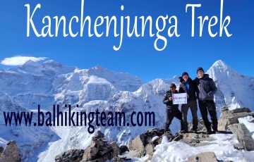
 Makalu Base Camp Trek cost with Guide and Porter 30-35$
16 days $1988
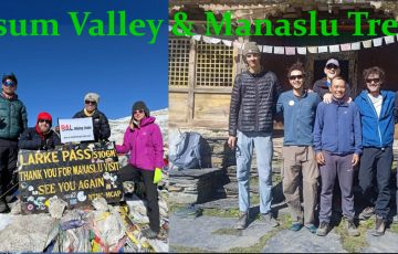
 Annapurna Base Camp (ABC) Trek
10 days $ 728
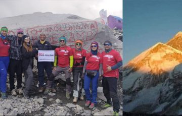
 Everest Three Passes Trek
18-19 Day $ 1700
 Everest Base Camp (EBC) Trek
14 Days $ 985
- Location : Gokyo Ri Trek
- Duration : 12 Days $ 1400
- Trek Grade : Easy
- Max Elevation : 5357 m
- Trek Style : Lodge
- Mode of Trek : lodges / Tea house treks
Quick Inquiry
Related Packages
-
Duration:21 days $ 2338
Trip Grade: Moderate
Max. Altitude
5`143 m
-
Duration:20 Day $1560
Trip Grade: Moderate
Max. Altitude
5106 m
-
Duration:14 day $ 706
Trip Grade: Moderate
Max. Altitude
5106 m
-
Duration:14 Days $ 985
Trip Grade: Moderate
Max. Altitude
5550 m

2025-06-10 16:48:53
KAma_Dablam, Washington DC, DC2 says:
Best Treks Gokey Treks Great experience, everything was very well organized at the same time pretty flexible. We very able to change the itinerary based on the health conditions of the travelers. Bal Hiking Team made an effort to put us in the be...