
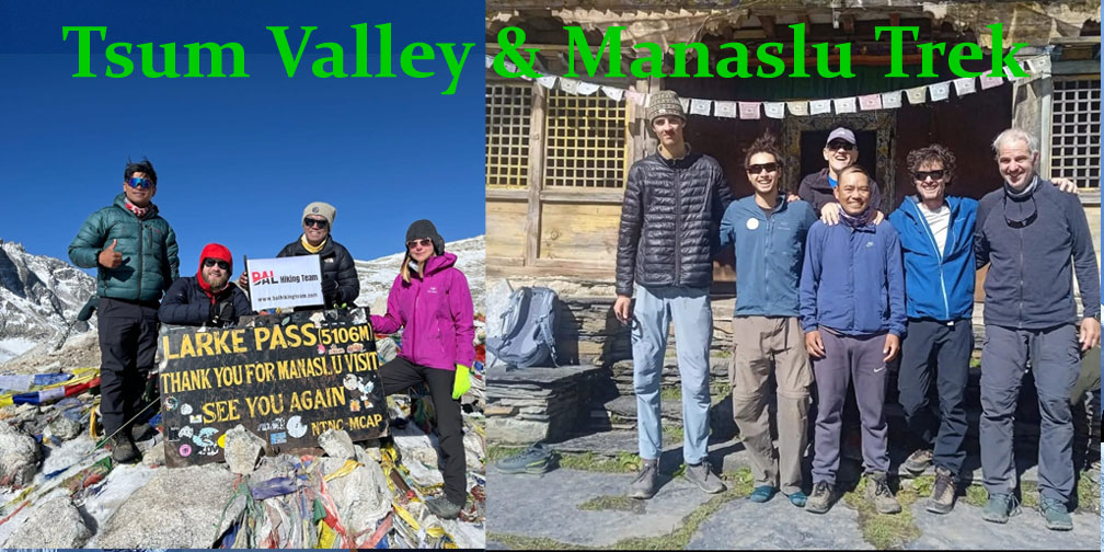
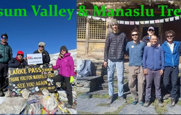
Tsum Valley and Manaslu Circuit Trek
Trip Introduction
The Tsum Valley and Manaslu Circuit Trek is a spectacular and culturally rich trekking route in the Nepalese Himalayas, combining the remote Tsum Valley with the more challenging Manaslu Circuit. It offers a unique blend of Buddhist culture, remote villages, pristine landscapes, and dramatic Himalayan scenery, including views of Mount Manaslu (8,163 m), the 8th highest mountain in the world.
Tsum and Manaslu Circuit Trek Package Cost
Standard 20-Days Package Cost: $1660 per person with Private Transport (Ktm to Machhakhola)
Standard 20-Days Package Cost:$1560 per person with Local Transport (Ktm to Machhakhola)
Note: Dharapani-Besisahar-Ktm will be Public Transportation, if you need Private Tourist Vehicle we provide but cost will be added.
Cost Includes Package :
 Airport Pickup and Drop, All the Transportation accommodation during the trek,
full board meals, breakfast , lunch, dinner ,Tea, Coffee, during the treks
All necessary permits MCP, ACP, special permits Manaslu cricuit Tsum valley trek,
one English speaking Government certificate holder trekking guide
Two trekkers between one porter they will carry around 2o to 25 kg)
Fingertip pulse Oximeter (we use every day to check your oxygen level and pulse in your body to avoid high risk.)
Guide and porter: food, lodge, transportation, salary, insurance, equipment etc.
13% Government Vat and official expenses.
Best available Room and Lodge during the treks.
Mocker spike for the ice when you going to over the Larkey pass to use for the Shoes .
Bal Hiking Team provide Duffel Bag packing your equipment during the treks
Seeping bag down Jacket for use during the treks , after you will be refund for Agency ( if you requirement)
Trekking Certificates, Staffs first aid kid, for high passes mini crampons,
Seasonal fresh fruits and Biscuits etc.
From kathamandu to Machhakhola by provide car or jeep Public Bus
Tillche or Darapani to Besishar sharing Jeep and Car and Public Bus by kathamandu
Excludes Package :
 Coke ,Fanta, beer , Whiskey , better changing , wifi, hot shower, water ect.
You trekking gears Helicopter, Trekking Equipment
International flights,
Hotel in Kathmandu,Nepal visa, Travel insurance,
Guide /Porter trekking staff Tips personal expenses.
Tsum Valley Trek Itinerary 20 days
Day 1: Arrival in Kathmandu (1,350 m)
Activities:
-Arrive at Tribhuvan International Airport (TIA).
-Drive to your Hotel, Bal Hiking Team will Pick you.
-Secure trekking permits with Bal Hiking Team
-Accommodation: Hotel/hostel as per your Choice.
-Meals: No
Day 2: Kathmandu → Soti Khola→ Machhakhola (900 m)
Transport:
Drive from Kathmandu to Machhakhola (approx. 8–9 hours by jeep/bus, ~170 km; rugged mountain roads).
Highlights:
-Cross Budi Gandaki River by motorable bridges; first taste of Himalayan foothills.
–Start to drive 7 am around.
-Gorges, waterfalls along riverbanks, glimpses of Manaslu’s southern flanks.
-Overnight: Tea-house at Machha Khola.
-Meals:B/L/D with Tea and Coffee
Day 3: Machha Khola to Jagat
-Distance & Time: ~21 km; 7–8 hours
-Elevation Gain: 930 m → 1,410 m
-Route: Gradual ascent along Machha Khola to Dobhan (where Budhi Gandaki River merges), then climb to Jagat. Trail passes through Bharkhu Khola and Lokpa Village.
-Accommodation: Tea-house in Jagat (the last major checkpoint before entering Manaslu Conservation Area).
Highlights:
-The juncture of Machha Khola and Budhi Gandaki River at Dobhan.
-Cultural interaction: Passing through Lokpa, inhabited by Gurung communities.
Day 4: Jagat to Lokpa or Chumling
-Distance & Time: ~16 km; 6–7 hours
-Elevation Gain: 1,410 m → 2,070 m
-Route: From Jagat, trek through Sirdibas (1,660 m), cross a large suspension bridge over Budhi Gandaki, and ascend steeply along stone steps to Lokpa (2,175 m). Descend briefly to Chumling.
-Accommodation: Tea-house at Lokpa/ Chumling.
Highlights:
-Entering the core Manaslu Conservation Area.
-First views of terraced farmland built into steep terraced slopes.
-Chumling: A small “entrance” village to Tsum, with prayer flags and Mani walls.
Day 5: Chumling to Chhokangparo
-Distance & Time: ~12 km; 5–6 hours
-Elevation Gain: 2,070 m → 3,306 m
Route: Steep ascent from Chumling through dense rhododendron and pine forests to Roo (2,700 m). From Roo, climb past Tatopani (hot spring) and cross the Budhi Gandaki on a high suspension bridge. Continue through Philim and on to Chhokangparo.
Accommodation: Tea-house in Chhokangparo.
Highlights:
Tatopani Hot Springs: Natural hot springs at about 2,700 m—ideal to soak and relieve sore muscles.
Chhokangparo: Traditional Tsum settlement with stone-and-mud homes; first immersion into Tsum’s unique Buddhist culture.
Day 6: Chhokangparo to Nile
Distance & Time: ~10 km; 5–6 hours
Elevation Gain/Loss: 3,306 m → 2,620 m (with intermediate ups and downs)
Route: Descend from Chhokangparo through pine forest to the Budhi Gandaki River’s west bank. Cross on a long suspension bridge to reach Nile.
Accommodation: Tea-house in Nile.
Highlights:
-Homeric views of vertical gorge walls etched by Budhi Gandaki River.
-Nile Village: Traditional Tsum settlement—look for stone-built houses, mani walls, and chortens.
Day 7: Nile to Mu Gompa
Distance & Time: ~13 km; 6–7 hours
Elevation Gain: 2,620 m → 3,700 m
Route: From Nile, ascend steeply through terraced fields and small hamlets (Rachen Gompa at 3,520 m) to Mu Gompa (3,700 m), the head of Tsum Valley.
Accommodation: Basic dormitory at Mu Gompa (run by local monastery). Rooms are very simple; heating is minimal.
Highlights:
Rachen Gompa: A small gompa perched above a steep cliff—first panoramic views of the higher Himalaya (Baudha Himal, Ganesh Himal, Himalchuli).
Mu Gompa: The focal monastery of Tsum Valley; possibility to attend morning prayers, meet monks, and witness daily life at 3,700 m.
Day 8: Acclimatization & Exploration at Mu Gompa
Activities:
-Morning Puja at Mu Gompa: Observe or participate in Buddhist rituals and chantings.
-Day Hike to Nagdalo (4,110 m): Offers sweeping views of Ganesh Himal, Sringi Himal, and the Tsum Valley ring of peaks. Round-trip 4–5 hours.
-Visit Tibetan-style hermitages: Such as Ringmo Cave (3,900 m) to see meditation caves.
-Accommodation: Same dormitory at Mu Gompa.
Highlights:
-Panoramic mountain vistas—Ganesh Himal range to the west; Baudha and Sringi Himal to the north.
-Spiritual ambiance of the high-altitude monastery.
Day 9: Mu Gompa to Chumling
Distance & Time: ~18 km; 7–8 hours
Elevation Loss: 3,700 m → 2,070 m
Route: Retrace steps through Nile and Chhokangparo, then descend to Chumling.
Accommodation: Tea-house in Chumling.
Highlights:
-Smoother descent but long travel day.
-Opportunity to revisit villages, interact with locals, and purchase small Tibetan-style handicrafts.
Day 10: Chumling to Lokpa
The trek from Chumling (2,386 m) down to Lokpa (≈2,040 m) covers approximately 6.3 km and takes about 4–5 hours on average. Although the net elevation change is a descent of roughly 346 meters, the trail undulates through forested ridges and crosses suspension bridges, so expect a mix of short climbs and drops along the way.You’ll gain views of Ganesh Himal and Buddha Himal as you traverse wooded slopes and river valleys, passing prayer mani walls and occasional chortens before arriving at the junction village of Lokpa, which sits at the confluence of the Siyar Khola and Budhi Gandaki rivers
Day 11: Lokpa Deng
The trek from Lokpa (2,240 m) down to Deng (1,860 m) is a moderately easy day’s walk that covers roughly 12 km with a net descent of about 380 m. You will leave the secluded Tsum Valley trail at Lokpa and rejoin the main Budhi Gandaki route, passing through small Gurung settlements before descending into Deng. The entire day typically takes 5–6 hours of hiking, depending on pace and weather
Day 12: Deng (1,860 m) → Namrung (2,630 m)
-Trekking Time: 6–7 hours (13 km)
Route:
-Steep climb out of Deng; forest transitions from subtropical to temperate.
-Cross Namrung Khola, pass through bamboo groves, then cross a small waterfall.
-Arrive at Namrung, a Tibetan-influenced village at a flatter shelf.
Highlights:
-First wide views of Manaslu’s south face.
-Mani walls, prayer flags at village outskirts.
-Overnight: Lodge in Namrung.
-Meals: B/L/D with Tea and Coffee
Day 13: Namrung (2,630 m) → Lho (3,180 m)
-Trekking Time: 5–6 hours (11 km)
Route:
-Climb gradually through alpine pastures; cross streams via logs/bridges.
-Pass through Samagaon Valley on opposite side; continue north to Lho.
Highlights:
-Lho Monastery: Historic gompa (built 1760 AD), murals.
-Panoramic views of Manaslu (8,163 m), Ngadi Chuli (7,871 m).
-Overnight: Guesthouse in Lho.
-Meals: B/L/D with Tea and Coffee
Day 14: Lho (3,180 m) → Samagaon (3,530 m)
-Trekking Time: 4–5 hours (8 km)
Route:
-Easy uphill through grazing lands; only one short descent into glacial moraine before Samagaon.
-Arrive early, allowing half-day acclimatization.
Highlights:
–Pungen (Birendra Tal) Lake (4,370 m) day‑hike option; 3–4 hours round trip.
–Manaslu Base Camp Viewpoint (5–6 hours round trip): 4,100 m, superb 360° panorama of surrounding peaks.
-Overnight: Lodge in Samagaon.
-Meals: B/L/D with Tea and Coffee
Day 15: Acclimatization Day at Samagaon (3,530 m)
Activities:
-Pungen Tsho Trek: Follow glacial streams to a small lake, surrounded by 6,000–7,000 m peaks.
-Alternatively, a short hike to Ribung Gompa (~1 hour) to see Tibetan-influenced monastery and giant prayer wheel.
Purpose:
-Aid acclimatization before crossing Larkya La Pass (5,106 m).
-Overnight: Same lodge in Samagaon.
-Meals: B/L/D with Tea and Coffee
Day 16: Samagaon (3,530 m) → Samdo (3,860 m)
-Trekking Time: 4–5 hours (8 km)
Route:
-Gentle uphill through glacial moraines and pasturelands.
-Reach Samdo, last Nepali village before Tibetan border; many trekkers spend an extra night here if needed.
Highlights:
–Samdo Glacier: to the east, massive ice.
-Stone‑walled fields, yak pastures.
-Overnight: Lodge in Samdo.
-Meals: B/L/D with Tea and Coffee
Day 17: Samdo (3,860 m) → Dharmasala / Larkya Phedi (4,460 m)
Trekking Time: 5–6 hours (9 km)
Route:
-Initially gentle, then steep climb along moraine slopes.
-Trail narrows across loose moraine; occasionally snow-covered (especially post‑October).
-Arrive at Larkya Phedi or rudimentary shelters (“Dharmasala”), where tea-houses are very basic—some only have mats on the floor. Drink plenty of liquids.
Highlights:
-Dramatic glacier views from Larkya Phedi.
-Establish last water source before the pass.
-Overnight: Basic tea-house or tented lodge at Larkya Phedi (often ≤4 °C at night).
-Meals: B/L/D with Tea and Coffee
Day 18: Larkya Phedi (4,460 m) → Bimtang (3,720 m) via Larkya La Pass (5,106 m)
-Trekking Time: 9–11 hours (17 km total)
Route:
-Pre-dawn start (~3–4 AM) to ascend ~650 m on scree/snow to the Larkya La Pass (5,106 m).
-Expect 4–5 hours to the pass: innumerable switchbacks; use crampons if needed.
-From the pass, steep descent (rocky, loose terrain) to Bhimtang.
Highlights:
-Larkya La Summit: Unobstructed views of Himal Chuli (7,893 m), Cheo Himal (6,800 m), Ngadi Chu Glacier, and on a clear day, the crest of the Annapurna range far west.
-Glacier-fed streams; alpine meadows on the descent.
-Overnight: Tea-house in Bhimtang (teahouses are basic: cold showers and limited menus, but the scenery is spectacular).
-Meals: B/L/D with Tea and Coffee
Day 19: Bimtang (3,720 m) → Dharapani (1,860 m)
-Trekking Time: 7–8 hours (18 km)
Route:
-Descend through meadows, cross Gudhi Gandaki Valley, passing Himal Chuli Base Camp junction.
-Continue past Tal Village (3,330 m), then through Bagar, crossing suspension bridges over Gandaki River.
-Final descent to Dharapani.
Highlights:
-Views of Himalchuli from the valley floor.
-Oak and pine forests transitioning to warmer, lower elevations.
-Overnight: Lodge in Dharapani.
-Meals: B/L/D with Tea and Coffee
Day 20: Dharapani (1,860 m) → Besisahar (760 m) → Kathmandu (1 350 m)
-Total driving distance: ~229 km
-Dharapani → Besisahar: ≈ 53 km
-Besisahar → Kathmandu (via Prithvi Highway): ≈ 176 km
-Total ≥ drive time: ~10–12 hours (including breaks)
-Meals: B/L/D with Tea and Coffee
-Hotel: No
-Meals: B/L with Tea and Coffee
Note: Extend your days as per your need in Kathmand and on your departure to Airport, Bal Hiking Team will drop you by Private Transport.
Tsum Valley Trek Permit Costs
Tsum Valley lies within the Manaslu Restricted Area and requires multiple permits to enter. Below are the main fees you’ll encounter:
Tsum Valley Restricted Area Permit (TV-RAP)
September–November (Autumn)
-USD 40 for the first 7 days
-USD 7 per extra day beyond 7 days
December–August (Winter, Spring, Summer)
-USD 30 for the first 7 days
-USD 7 per extra day beyond 7 days
Manaslu Conservation Area Permit (MCAP)
-Foreign nationals: NPR 3,000 (≈ USD 30)
-SAARC nationals: NPR 1,000
-Nepali citizens: NPR 100
Manaslu Restricted Area Permit (RAP)
If you combine Tsum Valley with the full Manaslu Circuit, you must also purchase the Manaslu RAP (covers Jagat–Dharapani section).
September–November (Autumn)
-USD 100 for the first 7 days
-USD 15 per extra day beyond 7 days
December–August (Winter, Spring, Summer)
-USD 75 for the first 7 days
-USD 10 per extra day beyond 7 days
Chumnubri Rural Municipality Permit
-Foreign nationals: NPR 1,000
-SAARC nationals: NPR 1,000
-Nepali citizens: NPR 100
This fee is payable in Gorkha (or through your agency) and supports local infrastructure.
Annapurna Conservation Area Permit (ACAP)
Required only if you extend into the Annapurna Conservation Area (e.g., Annapurna Sanctuary or AC loop).
-Foreign nationals: NPR 3,000 (≈ USD 30)
-SAARC nationals: NPR 1,000
Manaslu Circuit Trek Permit Costs
If you’re trekking the standard Manaslu Circuit (Jagat → Dharapani → Larke Pass → Besisahar) but not detouring into Tsum Valley, you still need:
Manaslu Restricted Area Permit (RAP)
September–November (Autumn)
-USD 100 for the first 7 days
-USD 15 per extra day beyond 7 days
December–August (Winter, Spring, Summer)
-USD 75 for the first 7 days
-USD 10 per extra day beyond 7 days
Manaslu Conservation Area Permit (MCAP)
-Foreign nationals: NPR 3,000
-SAARC nationals: NPR 1,000
-Nepali citizens: NPR 100
Chumnubri Rural Municipality Permit
-Foreign nationals: NPR 1,000
-SAARC nationals: NPR 1,000
-Nepali citizens: NPR 100
Annapurna Conservation Area Permit (ACAP)
Required only if your route later joins any part of the Annapurna Conservation Area.
-Foreign nationals: NPR 3,000
-SAARC nationals: NPR 1,000
Tsum Valley and Manaslu Circuit Trek Highlights
Sacred Himalayan “Hidden Valley”
-Tsum (also spelled “Tum”) means “vivid valley” in Tibetan, and this region was closed to outsiders until 2008. Its spiritual atmosphere remains very strong, with dozens of old gompas (monasteries), mani walls, and chhortens dotting the villages.
-You’ll pass through villages like Gompa (Sikha), Chumling, and Chhokangparo, each offering welcome teahouse stays and a chance to witness ritual butter‐lamp offerings, mask dances (often in autumn), and the quiet devotion of local monks.
Rich Buddhist Culture & Ancient Artifacts
-Rimskhul Cave (22,000 ft / 6,705 m) is a meditation cave where legend says Milarepa (11th-century Tibetan yogi) and Jamgon Kongtrul meditated. The cave’s interior is dimly lit by butter lamps, and prayer flags flutter around its mouth.
-Lokpa Gurung Village features ancient mani stones and unique stone houses built in traditional Gurung style. It’s a great place to glimpse life as it was for generations—yak herding, small‐scale barley farming, and time—honored festivals such as Lhosar (New Year).
Stunning Waterfalls & Terraced Fields
-Between the villages of Chumling and Chhokangparo, you’ll walk past a series of dramatic waterfalls cascading down steep rock faces surrounded by rhododendron forests.
-The terraced fields on steep slopes, planted with millet and buckwheat, offer a patchwork of greens and golds, especially beautiful in late spring (April–May) when rhododendrons bloom.
Views of Ganesh Himal & Himalchuli
-Although Tsum is more enclosed than the main valley, you still get occasional glimpses of snow-capped peaks: Ganesh Himal to the southwest and Himlung Himal to the north. Sunrise and sunset colors on these peaks are especially memorable from viewpoints near Chhokangparo.
Local Hospitality & Teahouse Stays
-Accommodations are basic but warm—wood-stove teas, dal bhat prepared in yak-dung-fueled kitchens, and sleep in simple wooden lodge rooms.
-Hosts often invite guests into their main family room, where you can try local butter tea, yak cheese, and homemade barley beer.
Larkya La Pass (5,160 m / 16,930 ft)
Pre-Pass Ambience at Dharmasala (near Bhimtang)
-Upper Bhimthang (13,000 ft / 3,950 m) is a flat, green pasture surrounded by towering peaks. On a clear morning, you see Manaslu’s south face rising almost vertically.
-Many trekkers camp or stay in thin-walled lodges here, under the watchful gaze of Cheo Himal (6,820 m) and Himalchuli.
Crossing Day
-The ascent to Larkya La starts pre-dawn if you want to catch sunrise on the pass. The trail zigzags up a scree slope, gaining over 1,100 m in elevation.
-From the top (5,160 m), you’re rewarded with a 360° panorama:
–Manaslu Massif (east), including peaks like Manaslu East, Shringi Himal, and Ngadi Chuli.
-Himalchuli & Cheo Himal to the west.
-If skies are clear, you can pick out Kawagebo in the far distance.
-Many trekkers pause for 15–30 minutes on the pass to snap photos and take stock of altitude—there can be a strong wind, so heavy jackets are advisable even in late spring.
Wildlife & Flora
-Himalayan Thar & Blue Sheep often graze near high-altitude meadows around Bimthang and Larkya La.
-Red‐panda Habitat: Lower slopes around Jagat and Deng are within the Kanchenjunga‐Manaslu corridor, where sightings of red pandas are possible although rare.
-Rhododendron Forests: In May, rhododendron trees explode in a riot of reds and pinks between 2,400 m and 3,500 m.
-Juniper & Birch: Above 3,500 m, juniper thickets and dwarf birch hug the hillsides, giving the landscape its classic alpine look.
The Tsum Valley and Manaslu Circuit treks fall within a “restricted area” of Nepal, requiring special permits and careful planning. Both routes traverse high-altitude passes, remote villages, and river valleys, so seasonal weather patterns heavily influence safety, trail conditions, and overall experience. After reviewing multiple trekking resources, the clear consensus is:
Spring (March–May)
Autumn (September–November)
Below is a breakdown of each season’s advantages—and why the monsoon (June–August) and winter (December–February) are generally avoided.
Spring Season (March, April, May)
Why it’s ideal:
Temperatures gradually warm up after winter, usually ranging from 5 °C to 15 °C at higher elevations, making the steep climbs to passes like Larkya La (5,106 m) more comfortable. The thawing snow ensures that trails are mostly clear of ice (except on very early-season days).
Blooming rhododendrons and wildflowers paint the lower ridgelines red, pink, and white, especially between 2,500 m and 3,500 m—this is a highlight of trekking in spring.
Stable weather windows: Days are generally dry with clear skies, offering excellent mountain vistas of Mt. Manaslu (8,163 m) and Ganesh Himal ranges.
Longer daylight than in winter means more trekking hours; typically 10–12 hours of daylight by April.
Risks & considerations of Tsum Valley and Manaslu Circuit Trek:
Early spring (late February–early March) can still have lingering snowstorms at passes, so it’s best to start in mid-March or later.
As the season progresses into late May, occasional pre-monsoon thundershowers begin to appear, especially around Tatopani (1,190 m) and lower elevations.
Sources:
-“Spring (March, April, May) . . . The weather is generally stable, with mild temperatures and clear skies . . . Longer daylight hours allow for more comfortable and enjoyable trekking days.”
-“April is the best month for trekking in Manaslu Circuit during spring. The days get warmer day by day, and there is plenty of sunlight that offers excellent visibility. All the surroundings turn green, giving the experience a vibrant one.”
Autumn Season (September, October, November)
Why it’s ideal:
Post-monsoon clearing: By early September, the heavy monsoon rains subside. Trails dry quickly, and dusty or muddy sections improve, reducing the risk of landslides on steep sections like those between Deng (1,804 m) and Namrung (2,630 m).
Crystal-clear skies: With the monsoon moisture gone, days are usually sunny with visibility of 100+ km, allowing spectacular panoramic views from vantage points such as the Larkya La Pass and viewpoints around Samdo (3,860 m).
Moderate temperatures: Daytime highs around 10 °C–20 °C up to 3,000 m. Nights are cooler but remain above freezing up to Samdo; above 4,000 m, expect frost.
Festivals & cultural immersion: Local villages celebrate harvest festivals like Teej (late August/early September), offer insights into Tibetan Buddhist culture in Tsum Valley (3,630 m), and provide opportunities to see mani walls and gompas draped in prayer flags.
Risks & considerations:
Peak-season crowds: While still remote compared to Everest or Annapurna, the Manaslu-Tsum corridor sees more groups in September–October; early booking for teahouses around Samagaun (3,530 m) is recommended.
Temperature fluctuations: By November, nights at 4,460 m (Dharamsala/Larkya Phedi) can dip to –5 °C or lower, so warm sleeping bags (rated –10 °C or better) are essential.
Sources:
-“Among all the Manaslu circuit trekking seasons, autumn is the best season for the Manaslu circuit trek. The weather is stable, the temperature is moderate, and the trails are dry and possess minimal risks. Likewise, autumn offers the best panoramic view of mountains . . .”
-“The best time to trek the Manaslu Circuit and Tsum Valley is during the autumn (September to November) . . . These months offer the most favorable weather conditions and ensure a memorable trekking experience.
Monsoon Season (June, July, August) – Generally Not Recommended
Heavy rainfall & landslides: Monsoon delivers 70–80 % of annual precipitation to the Manaslu region, causing slippery, mud-saturated trails between Machha Khola (896 m) and Jagat (1,340 m), and frequent landslides along the Budhi Gandaki valley.
Low visibility: Clouds often wrap around 3,000 m and above, obscuring views of Ganesh Himal and Manaslu. Monsoon drizzle can extend daily, making tents and teahouses damp.
River crossings become riskier: Bridges (e.g., Budhi Gandaki suspension bridges) can be damaged or submerged after heavy downpours.
Exceptions: Very experienced mountaineers or riders sometimes cross early monsoon windows in late June, but this is best left to professionals with local weather support.
Sources:
-“The monsoon season has the worst visibility, with frequent clouds, fog, and rain making it difficult to appreciate the surrounding mountains. So trekking in monsoon season is very difficult, with muddy, slippery trails, and the risk of landslides significantly increases the number of hazards.”
-“The summer months of June, July, and August fall in the active monsoon time hence leading to wet slipping paths trudging in Nepal.”
Winter Season (December, January, February) – Generally Not Recommended
Extreme cold & snowfall: Temperatures at 4,000 m+ can plummet to –15 °C or lower, with frequent snowstorms closing high-altitude lodges (especially beyond Mu Gompa, 3,700 m). Larkya La (5,106 m) often becomes impassable due to deep snow, and avalanche danger rises on slopes above 4,500 m.
Limited lodging & permits: Many teahouses in Samdo (3,860 m), Dharamsala (4,460 m), and Bhimtang (3,720 m) close for the season. Permits are still required but fewer services exist, so you must carry a tent or rely on scarce winter lodges.
Short daylight: Only ~9–10 hours of daylight in December/January means less time for high-altitude gains, increasing altitude-sickness risk if you have to push days.
Exceptions: Very few hardcore expedition treks attempt Larkya La in January–February, but this is only for climbers with full winter mountaineering gear and local support. Sources:
-“Winter is a challenging and risky time to do trekking in Nepal. The Manaslu region especially faces extreme cold and heavy snowfall. The Larkya La pass often becomes impassable during winter, and the trails are icy, which can be dangerous.”
-“In winter when there is heavy snowfall, the lodge in Mu Gompa closes due to such snow.”
Accommodation in Tsum Valley and Manaslu Circuit Trek
Tea Houses and Lodges
Structure and Amenities
-Most villages along the Manaslu Circuit and throughout the Tsum Valley have one or two tea houses or lodges. These are usually two- to three-story buildings constructed from local stone or wood.
-Rooms are typically twin-share (two single beds). Occasionally, triple-share rooms exist in busier stops like Namrung, Samagaun, or Chumling (in Tsum).
-Windows often have wooden shutters or simple glass panes. Floors can be wooden or concrete.
Heating: A central communal dining area often has a wood-burning stove (locally called a “bhatti”). Guest rooms may or may not have their own stove; if they do, you’ll share it with other guests in the same room.
Bathrooms: Most tea houses offer a shared squat or western-style toilet—one for men and one for women. In lower-altitude villages (e.g., Machha Khola, Jagat), some guesthouses have private bathrooms attached to rooms. Above 3,500 m (e.g., Samagaun, Chumling), expect to pay for hot water and often take bucket showers rather than continuous-flow showers.
Typical Overnight Stops
Lower Sector (up to 2,700 m): Machha Khola, Jagat, Deng. Here the lodges are relatively newer, more rooms, and menus are broader.
Mid Sector (2,700 m – 3,500 m): Namrung, Lho, Sama Gaun. Moderate facilities—rooms are smaller; fewer bath-to-room ratios.
Tsum Valley Villages (2,600 m – 3,700 m): Chumling (2,600 m), Chokhangparo (3,040 m), Chhule (3,340 m), Phurbe (3,500 m). In these remote villages, lodges are sparse (often only 1–2 per village). Expect very basic rooms: a simple bed with two woolen blankets, a pillow, and little else. Electricity may be available only via solar panels from ~6 pm–9 pm.
High Camp (3,900 m – 4,460 m): Near Pungen and Samdo, lodges are extremely basic: a single communal room for sleeping (often “roofed lodge” instead of an enclosed building), shared mats on the floor. Bring a sleeping bag rated for at least –10 °C because blankets can be damp.
Cultural Immersion: In a few villages like Chumling and Chhule, families offer homestay experiences. You sleep in their simple single-room home, have meals cooked by the family, and share their living space.
Facilities: No private bathroom; you use the family’s toilet (often an outhouse). Heating comes from a central stove shared by the whole household. Expect very basic bedding (thin quilts).
Cost: NPR1500 (USD 14-16) per night, including two meals. Homestays sometimes cost slightly less than the tea house in that village but are subject to availability.
Menu Items of Tsum Valley and Manaslu Circuit Trek
Dal Bhat Set (Traditional Nepali Meal):
Breakfast: Typically includes plain dal bhat: boiled rice, lentil soup, a vegetable curry (locally available veggies like cauliflower, potatoes, beans), sometimes scrambled egg or omelet (extra cost), and occasional pickle. In higher villages, eggs may not always be available.
Lunch & Dinner:
-A full dal bhat allows free “refills” of rice and lentil soup. Side dishes may change: mushrooms (when available), spinach, potatoes, or local herbs. At lower elevations, you’ll also find chicken or yak meat curry (extra cost: NPR 800–1200).
Other Common Dishes:
Thukpa: Tibetan-style noodle soup with vegetables or momos (dumplings) in soup.
Momolay (Dumplings): Steamed or fried—vegetable, yak, cheese, or chicken filling.
Chow Mein/Noodles: Oil-fried noodles with vegetables.
Pancakes/French Toast/Omelets: Common breakfast additions in mid-altitude lodges.
Snacks: Cookies, chocolate bars, instant noodles, canned tuna—brought in by porters or jeeps, so availability diminishes the higher you go.
Tea & Beverages:
Ginger-lemon or lemon tea: Often free with meals.
Milk tea (Chiya): A staple in the mornings and evenings—black tea brewed with milk and sugar.
Hot Chocolate/Coffee: Widely available in lower-altitude lodges; as you ascend above 3,500 m, expect limited coffee (instant) and powdered hot chocolate.
Bottled Water: Available for purchase (NPR 150–300 per liter above Sangke – often freeze-thaw makes it pricey). Many trekkers use purifying tablets or filter bottles instead.
Tip: Ordering dal bhat for dinner is often the best value since you can refill rice and dal to fuel you for long trekking days.
Variations in the Tsum Valley
Limited Supply: Villages in the Tsum Valley (e.g., Chumling, Chhule, Phurbe) receive supplies by porters or mules once a week. As a result:
Menu Variety Shrinks: Above Chhule (3,340 m), you may only find dal bhat, thukpa, and instant noodles. Fresh vegetables become rare, so curry options are limited to potatoes, dried mushrooms, or cabbage when in season.
Meal Timing: Kitchens may close earlier (around 7 pm) to conserve fuel. If you want dinner past 6 pm, inform the lodge in advance.
Price Increase: A dal bhat in Chhule/Phurbe can cost NPR 600–800 (USD 5–7) because everything must be carried in.
What to Expect & Preparation Tips
Carry Extra Snacks:
-It’s wise to bring trail-mixes, energy bars, and dry fruit from Kathmandu or the trailhead (Soti Khola). High-elevation lodges may run out of packaged snacks.
Altitude Consideration:
-Appetite might decrease above 4,000 m (near Samdo). Always force yourself to eat carbohydrates and drink plenty of fluids—even if the options are limited.
Shared Dining Culture:
-Meals are communal. You’ll often find trekkers from various countries seated together around the stove. It’s a great way to meet fellow trekkers and share tips about weather or trail conditions.
Bring a Reusable Utensil Set:
-Most tea houses provide metal plates, a bowl, a fork, spoon, and “doko” (wooden teacup). If you prefer your own lightweight spork or collapsible bowl, bring it to reduce waste.
Special Dietary Needs:
-Vegetarian: Easily accommodated—dal bhat, vegetable curries, and noodle dishes are staples.
-Vegan: Slightly more challenging; request no butter or cheese (often used in tea or curries). Inform your guide/porters.
-Gluten-Free: Limited, but you can survive on rice, lentils, potatoes, eggs (if you consume them), and soups—avoid noodles and bread. Always check with the cook as flours sometimes cross-contaminate cooking surfaces.
Detail Itenerary
-
Tsum Valley Trek Itinerary 20 days
Day 1: Arrival in Kathmandu (1,350 m)
Activities:
-Arrive at Tribhuvan International Airport (TIA).
-Drive to your Hotel, Bal Hiking Team will Pick you.
-Secure trekking permits with Bal Hiking Team
-Accommodation: Hotel/hostel as per your Choice.
-Meals: No
Day 2: Kathmandu → Soti Khola→ Machhakhola (900 m)
Transport:
Drive from Kathmandu to Machhakhola (approx. 8–9 hours by jeep/bus, ~170 km; rugged mountain roads).
Highlights:
-Cross Budi Gandaki River by motorable bridges; first taste of Himalayan foothills.
–Start to drive 7 am around.
-Gorges, waterfalls along riverbanks, glimpses of Manaslu’s southern flanks.
-Overnight: Tea-house at Machha Khola.
-Meals:B/L/D with Tea and Coffee
Day 3: Machha Khola to Jagat
-Distance & Time: ~21 km; 7–8 hours
-Elevation Gain: 930 m → 1,410 m
-Route: Gradual ascent along Machha Khola to Dobhan (where Budhi Gandaki River merges), then climb to Jagat. Trail passes through Bharkhu Khola and Lokpa Village.
-Accommodation: Tea-house in Jagat (the last major checkpoint before entering Manaslu Conservation Area).
Highlights:
-The juncture of Machha Khola and Budhi Gandaki River at Dobhan.
-Cultural interaction: Passing through Lokpa, inhabited by Gurung communities.
Day 4: Jagat to Lokpa or Chumling
-Distance & Time: ~16 km; 6–7 hours
-Elevation Gain: 1,410 m → 2,070 m
-Route: From Jagat, trek through Sirdibas (1,660 m), cross a large suspension bridge over Budhi Gandaki, and ascend steeply along stone steps to Lokpa (2,175 m). Descend briefly to Chumling.
-Accommodation: Tea-house at Lokpa/ Chumling.
Highlights:
-Entering the core Manaslu Conservation Area.
-First views of terraced farmland built into steep terraced slopes.
-Chumling: A small “entrance” village to Tsum, with prayer flags and Mani walls.
Day 5: Chumling to Chhokangparo
-Distance & Time: ~12 km; 5–6 hours
-Elevation Gain: 2,070 m → 3,306 m
Route: Steep ascent from Chumling through dense rhododendron and pine forests to Roo (2,700 m). From Roo, climb past Tatopani (hot spring) and cross the Budhi Gandaki on a high suspension bridge. Continue through Philim and on to Chhokangparo.
Accommodation: Tea-house in Chhokangparo.
Highlights:
Tatopani Hot Springs: Natural hot springs at about 2,700 m—ideal to soak and relieve sore muscles.
Chhokangparo: Traditional Tsum settlement with stone-and-mud homes; first immersion into Tsum’s unique Buddhist culture.
Day 6: Chhokangparo to Nile
Distance & Time: ~10 km; 5–6 hours
Elevation Gain/Loss: 3,306 m → 2,620 m (with intermediate ups and downs)
Route: Descend from Chhokangparo through pine forest to the Budhi Gandaki River’s west bank. Cross on a long suspension bridge to reach Nile.
Accommodation: Tea-house in Nile.
Highlights:
-Homeric views of vertical gorge walls etched by Budhi Gandaki River.
-Nile Village: Traditional Tsum settlement—look for stone-built houses, mani walls, and chortens.
Day 7: Nile to Mu Gompa
Distance & Time: ~13 km; 6–7 hours
Elevation Gain: 2,620 m → 3,700 m
Route: From Nile, ascend steeply through terraced fields and small hamlets (Rachen Gompa at 3,520 m) to Mu Gompa (3,700 m), the head of Tsum Valley.
Accommodation: Basic dormitory at Mu Gompa (run by local monastery). Rooms are very simple; heating is minimal.
Highlights:
Rachen Gompa: A small gompa perched above a steep cliff—first panoramic views of the higher Himalaya (Baudha Himal, Ganesh Himal, Himalchuli).
Mu Gompa: The focal monastery of Tsum Valley; possibility to attend morning prayers, meet monks, and witness daily life at 3,700 m.
Day 8: Acclimatization & Exploration at Mu Gompa
Activities:
-Morning Puja at Mu Gompa: Observe or participate in Buddhist rituals and chantings.
-Day Hike to Nagdalo (4,110 m): Offers sweeping views of Ganesh Himal, Sringi Himal, and the Tsum Valley ring of peaks. Round-trip 4–5 hours.
-Visit Tibetan-style hermitages: Such as Ringmo Cave (3,900 m) to see meditation caves.
-Accommodation: Same dormitory at Mu Gompa.
Highlights:
-Panoramic mountain vistas—Ganesh Himal range to the west; Baudha and Sringi Himal to the north.
-Spiritual ambiance of the high-altitude monastery.
Day 9: Mu Gompa to Chumling
Distance & Time: ~18 km; 7–8 hours
Elevation Loss: 3,700 m → 2,070 m
Route: Retrace steps through Nile and Chhokangparo, then descend to Chumling.
Accommodation: Tea-house in Chumling.
Highlights:
-Smoother descent but long travel day.
-Opportunity to revisit villages, interact with locals, and purchase small Tibetan-style handicrafts.
Day 10: Chumling to Lokpa
The trek from Chumling (2,386 m) down to Lokpa (≈2,040 m) covers approximately 6.3 km and takes about 4–5 hours on average. Although the net elevation change is a descent of roughly 346 meters, the trail undulates through forested ridges and crosses suspension bridges, so expect a mix of short climbs and drops along the way.You’ll gain views of Ganesh Himal and Buddha Himal as you traverse wooded slopes and river valleys, passing prayer mani walls and occasional chortens before arriving at the junction village of Lokpa, which sits at the confluence of the Siyar Khola and Budhi Gandaki rivers
Day 11: Lokpa Deng
The trek from Lokpa (2,240 m) down to Deng (1,860 m) is a moderately easy day’s walk that covers roughly 12 km with a net descent of about 380 m. You will leave the secluded Tsum Valley trail at Lokpa and rejoin the main Budhi Gandaki route, passing through small Gurung settlements before descending into Deng. The entire day typically takes 5–6 hours of hiking, depending on pace and weather
Day 12: Deng (1,860 m) → Namrung (2,630 m)
-Trekking Time: 6–7 hours (13 km)
Route:
-Steep climb out of Deng; forest transitions from subtropical to temperate.
-Cross Namrung Khola, pass through bamboo groves, then cross a small waterfall.
-Arrive at Namrung, a Tibetan-influenced village at a flatter shelf.
Highlights:
-First wide views of Manaslu’s south face.
-Mani walls, prayer flags at village outskirts.
-Overnight: Lodge in Namrung.
-Meals: B/L/D with Tea and Coffee
Day 13: Namrung (2,630 m) → Lho (3,180 m)
-Trekking Time: 5–6 hours (11 km)
Route:
-Climb gradually through alpine pastures; cross streams via logs/bridges.
-Pass through Samagaon Valley on opposite side; continue north to Lho.
Highlights:
-Lho Monastery: Historic gompa (built 1760 AD), murals.
-Panoramic views of Manaslu (8,163 m), Ngadi Chuli (7,871 m).
-Overnight: Guesthouse in Lho.
-Meals: B/L/D with Tea and Coffee
Day 14: Lho (3,180 m) → Samagaon (3,530 m)
-Trekking Time: 4–5 hours (8 km)
Route:
-Easy uphill through grazing lands; only one short descent into glacial moraine before Samagaon.
-Arrive early, allowing half-day acclimatization.
Highlights:
–Pungen (Birendra Tal) Lake (4,370 m) day‑hike option; 3–4 hours round trip.
–Manaslu Base Camp Viewpoint (5–6 hours round trip): 4,100 m, superb 360° panorama of surrounding peaks.
-Overnight: Lodge in Samagaon.
-Meals: B/L/D with Tea and Coffee
Day 15: Acclimatization Day at Samagaon (3,530 m)
Activities:
-Pungen Tsho Trek: Follow glacial streams to a small lake, surrounded by 6,000–7,000 m peaks.
-Alternatively, a short hike to Ribung Gompa (~1 hour) to see Tibetan-influenced monastery and giant prayer wheel.
Purpose:
-Aid acclimatization before crossing Larkya La Pass (5,106 m).
-Overnight: Same lodge in Samagaon.
-Meals: B/L/D with Tea and Coffee
Day 16: Samagaon (3,530 m) → Samdo (3,860 m)
-Trekking Time: 4–5 hours (8 km)
Route:
-Gentle uphill through glacial moraines and pasturelands.
-Reach Samdo, last Nepali village before Tibetan border; many trekkers spend an extra night here if needed.
Highlights:
–Samdo Glacier: to the east, massive ice.
-Stone‑walled fields, yak pastures.
-Overnight: Lodge in Samdo.
-Meals: B/L/D with Tea and Coffee
Day 17: Samdo (3,860 m) → Dharmasala / Larkya Phedi (4,460 m)
Trekking Time: 5–6 hours (9 km)
Route:
-Initially gentle, then steep climb along moraine slopes.
-Trail narrows across loose moraine; occasionally snow-covered (especially post‑October).
-Arrive at Larkya Phedi or rudimentary shelters (“Dharmasala”), where tea-houses are very basic—some only have mats on the floor. Drink plenty of liquids.
Highlights:
-Dramatic glacier views from Larkya Phedi.
-Establish last water source before the pass.
-Overnight: Basic tea-house or tented lodge at Larkya Phedi (often ≤4 °C at night).
-Meals: B/L/D with Tea and Coffee
Day 18: Larkya Phedi (4,460 m) → Bimtang (3,720 m) via Larkya La Pass (5,106 m)
-Trekking Time: 9–11 hours (17 km total)
Route:
-Pre-dawn start (~3–4 AM) to ascend ~650 m on scree/snow to the Larkya La Pass (5,106 m).
-Expect 4–5 hours to the pass: innumerable switchbacks; use crampons if needed.
-From the pass, steep descent (rocky, loose terrain) to Bhimtang.
Highlights:
-Larkya La Summit: Unobstructed views of Himal Chuli (7,893 m), Cheo Himal (6,800 m), Ngadi Chu Glacier, and on a clear day, the crest of the Annapurna range far west.
-Glacier-fed streams; alpine meadows on the descent.
-Overnight: Tea-house in Bhimtang (teahouses are basic: cold showers and limited menus, but the scenery is spectacular).
-Meals: B/L/D with Tea and Coffee
Day 19: Bimtang (3,720 m) → Dharapani (1,860 m)
-Trekking Time: 7–8 hours (18 km)
Route:
-Descend through meadows, cross Gudhi Gandaki Valley, passing Himal Chuli Base Camp junction.
-Continue past Tal Village (3,330 m), then through Bagar, crossing suspension bridges over Gandaki River.
-Final descent to Dharapani.
Highlights:
-Views of Himalchuli from the valley floor.
-Oak and pine forests transitioning to warmer, lower elevations.
-Overnight: Lodge in Dharapani.
-Meals: B/L/D with Tea and Coffee
Day 20: Dharapani (1,860 m) → Besisahar (760 m) → Kathmandu (1 350 m)
-Total driving distance: ~229 km
-Dharapani → Besisahar: ≈ 53 km
-Besisahar → Kathmandu (via Prithvi Highway): ≈ 176 km
-Total ≥ drive time: ~10–12 hours (including breaks)
-Meals: B/L/D with Tea and Coffee
-Hotel: No
-Meals: B/L with Tea and Coffee
Note: Extend your days as per your need in Kathmand and on your departure to Airport, Bal Hiking Team will drop you by Private Transport.
Array
Included in the Cost
Cost Includes Package :
Airport Pickup and Drop, All the Transportation accommodation during the trek,
full board meals, breakfast , lunch, dinner ,Tea, Coffee, during the treks
All necessary permits MCP, ACP, special permits Manaslu cricuit Tsum valley trek,
one English speaking Government certificate holder trekking guide
Two trekkers between one porter they will carry around 2o to 25 kg)
Fingertip pulse Oximeter (we use every day to check your oxygen level and pulse in your body to avoid high risk.)
Guide and porter: food, lodge, transportation, salary, insurance, equipment etc.
13% Government Vat and official expenses.
Best available Room and Lodge during the treks.
Mocker spike for the ice when you going to over the Larkey pass to use for the Shoes .
Bal Hiking Team provide Duffel Bag packing your equipment during the treks
Seeping bag down Jacket for use during the treks , after you will be refund for Agency ( if you requirement)
Trekking Certificates, Staffs first aid kid, for high passes mini crampons,
Seasonal fresh fruits and Biscuits etc.
From kathamandu to Machhakhola by provide car or jeep Public Bus
Tillche or Darapani to Besishar sharing Jeep and Car and Public Bus by kathamandu
Excludes Package :
Coke ,Fanta, beer , Whiskey , better changing , wifi, hot shower, water ect.
You trekking gears Helicopter, Trekking Equipment
International flights,
Hotel in Kathmandu,Nepal visa, Travel insurance,
Guide /Porter trekking staff Tips personal expenses.
1 Reviews on Tsum Valley and Manaslu Circuit Trek View All
Leave a Reply
-
All Inclusive Price 1560 $
-
Duration 20 Day $1560
Customer Review
1 reviews
 Makalu Base Camp Trek cost with Guide and Porter 30-35$
16 days $1988
 Annapurna Base Camp (ABC) Trek
10 days $ 728
 Everest Three Passes Trek
18-19 Day $ 1700
 Everest Base Camp (EBC) Trek
14 Days $ 985
- Location : Tsum Valley and Manaslu Circuit Trek
- Duration : 20 Day $1560
- Trek Grade : Moderate
- Max Elevation : 5106 m
- Trek Style : Lodge tea house
- Mode of Trek : lodges / Tea house treks
Quick Inquiry
Related Packages
-
Duration:21 days $ 2338
Trip Grade: Moderate
Max. Altitude
5`143 m
-
Duration:20 Day $1560
Trip Grade: Moderate
Max. Altitude
5106 m
-
Duration:14 day $ 706
Trip Grade: Moderate
Max. Altitude
5106 m
-
Duration:14 Days $ 985
Trip Grade: Moderate
Max. Altitude
5550 m

2025-06-12 16:23:57
tomphoe London, UK1 says:
Manaslu Circuit and Tsum Valley treks Bal and Bal Hiking Team are a professional outfit. They organised an excellent hike for us around the Manaslu Circuit and Tsum Valley treks at very short notice and made everything much easier than the other ...