
Manaslu Circuit Trek
Trip Introduction
The Manaslu Circuit Trek is a classic high-altitude loop around Mount Manaslu (8,163 m) in the Gorkha district of Nepal. Typically lasting 13 to 14 days (excluding international travel), it traverses remote villages, dense forests, glacial rivers, high passes, and up-close views of massive Himalayan peaks. Below is a 13 days sample itinerary (excluding the arrival day in Kathmandu), which you can adapt to 13 or 14 days depending on your pace, side‐trips, and rest days.
We have Six different package here,
Manaslu Circuit Trek food Package without porter Cost
Option : 01 ( minimum 2 pax)
Standard 12-Days Package Cost:$ 850 per person with Local Transport (Ktm to Machhakhola)
Note: Dharapani-Besisahar-Ktm will be Public Transportation, if you need Private Tourist Vehicle we provide but cost will be added.
Cost Includes Package :
 Airport Pickup and Drop, All the Transportation accommodation during the trek,
full board meals, breakfast , lunch, dinner during the treks
All necessary permits MCP, ACP, special permits Manaslu cricuit trek,
one English speaking Government certificate holder trekking guide
Fingertip pulse oximeter (we use every day to check your oxygen level and pulse in your body to avoid high risk.)
Guide : food, lodge, transportation, salary, insurance, equipment etc.
13% Government Vat and official expenses.
Best available Room and Lodge during the treks.
Mocker spike for the ice when you going to over the Larkey pass to use for the Shoes.
Bal Hiking Team provide Duffel Bag packing your equipment during the treks
Seeping bag down Jacket for use during the treks , after you will be refund for Agency ( if you requirement)
Trekking Certificates, Staffs first aid kid, for high passes mini crampons,
Seasonal fresh fruits .
From kathamandu to Machhakhola by Public Bus
Tillche or Darapani to Besishar sharing Jeep and Public Bus by kathamandu
Excludes Package :
 Coke ,fanta, beer , tea ,coffee Whiskey , better changing , wifi, hot shower, water ect.
Two trekkers between one porter they will carry around 2o to 25 kg) $ 240
kathamandu to Machakhola prive jeep $ 235 and Darapani to kathamandu $200
You trekking gears Helicopter, Trekking Equipment
International flights,
Hotel in Kathmandu,Nepal visa, Travel insurance,
Guide /Porter trekking staff Tips personal expenses.
Option 02
Standard 12-Days Package Cost: $1145 per person with Private Transport (Ktm to Machhakhola)
Standard 12-Days Package Cost:$1045 per person with Local Transport (Ktm to Machhakhola)
Note: Dharapani-Besisahar-Ktm will be Public Transportation, if you need Private Tourist Vehicle we provide but cost will be added.
Cost Includes Package :
Airport Pickup and Drop, All the Transportation accommodation during the trek,
full board meals, breakfast , lunch, dinner ,Tea, Coffee, during the treks
All necessary permits MCP, ACP, special permits Manaslu cricuit trek,
one English speaking Government certificate holder trekking guide
Two trekkers between one porter they will carry around 2o to 25 kg)
Fingertip pulse oximeter (we use every day to check your oxygen level and pulse in your body to avoid high risk.)
Guide and porter: food, lodge, transportation, salary, insurance, equipment etc.
13% Government Vat and official expenses.
Best available Room and Lodge during the treks.
Mocker spike for the ice when you going to over the Larkey pass to use for the Shoes.
Bal Hiking Team provide Duffel Bag packing your equipment during the treks
Seeping bag down Jacket for use during the treks , after you will be refund for Agency ( if you requirement)
Trekking Certificates, Staffs first aid kid, for high passes mini crampons,
Seasonal fresh fruits and Biscuits etc.
From kathamandu to Machhakhola by provide car or jeep Public Bus
Tillche or Darapani to Besishar sharing Jeep and Car Public Bus by kathamandu
Excludes Package :
Coke ,fanta, beer , Whiskey , better changing , wifi, hot shower, water ect.
You trekking gears Helicopter, Trekking Equipment
International flights,
Hotel in Kathmandu,Nepal visa, Travel insurance,
Guide /Porter trekking staff Tips personal expenses.
Manaslu Circuit Trek Package without tea Cost
Option: 03
Standard 12-Days Package Cost: $1085 per person with Private Transport (Ktm to Machhakhola)
Standard 12-Days Package Cost:$ 980 per person with Local Transport (Ktm to Machhakhola)
Note: Dharapani-Besisahar-Ktm will be Public Transportation, if you need Private Tourist Vehicle we provide but cost will be added.
Cost Includes Package :
Airport Pickup and Drop, All the Transportation accommodation during the trek,
full board meals, breakfast , lunch, dinner , during the treks
All necessary permits MCP, ACP, special permits Manaslu cricuit trek,
one English speaking Government certificate holder trekking guide
Two trekkers between one porter they will carry around 2o to 25 kg)
Fingertip pulse oximeter (we use every day to check your oxygen level and pulse in your body to avoid high risk.)
Guide and porter: food, lodge, transportation, salary, insurance, equipment etc.
13% Government Vat and official expenses.
Best available Room and Lodge during the treks.
Mocker spike for the ice when you going to over the Larkey pass to use for the Shoes.
Bal Hiking Team provide Duffel Bag packing your equipment during the treks
Seeping bag down Jacket for use during the treks , after you will be refund for Agency ( if you requirement)
Trekking Certificates, Staffs first aid kid, for high passes mini crampons,
Seasonal fresh fruits ,
From kathamandu to Machhakhola by provide car or jeep Public Bus
Tillche or Darapani to Besishar sharing Jeep and Car Public Bus by kathamandu
Excludes Package :
Coke ,fanta, beer , Whiskey , better changing , wifi, hot shower, water ect.
You trekking gears Helicopter, Trekking Equipment
International flights, tea coffee during the treks.
Hotel in Kathmandu,Nepal visa, Travel insurance,
Guide /Porter trekking staff Tips personal expenses.
Manaslu Circuit Trek B&B Package Cost
Option: 04
Standard 12-Days Package Cost: $ 905 per person with Private Transport (Ktm to Machhakhola)
Standard 12-Days Package Cost:$ 803 per person with Local Transport (Ktm to Machhakhola)
Note: Dharapani-Besisahar-Ktm will be Public Transportation, if you need Private Tourist Vehicle we provide but cost will be added.
Cost Includes Package :
Airport Pickup and Drop, All the Transportation accommodation during the trek,
breakfast with Tea, Coffee, (B&B with Room) during the treks
All necessary permits MCP, ACP, special permits Manaslu cricuit trek,
one English speaking Government certificate holder trekking guide
Two trekkers between one porter they will carry around 2o to 25 kg)
Fingertip pulse oximeter (we use every day to check your oxygen level and pulse in your body to avoid high risk.)
Guide and porter: food, lodge, transportation, salary, insurance, equipment etc.
13% Government Vat and official expenses.
Best available Room and Lodge during the treks.
Mocker spike for the ice when you going to over the Larkey pass to use for the Shoes.
Bal Hiking Team provide Duffel Bag packing your equipment during the treks
Seeping bag down Jacket for use during the treks , after you will be refund for Agency ( if you requirement)
Trekking Certificates, Staffs first aid kid, for high passes mini crampons,
Seasonal fresh fruits,
From kathamandu to Machhakhola by provide car or jeep Public Bus
Tillche or Darapani to Besishar sharing Jeep and Car Public Bus by kathamandu
Excludes Package :
full board meals, breakfast , lunch, dinner ,Tea, Coffee, during the treks
Coke ,nta, beer , Whiskey , better changing , wifi, hot shower, water ect.
You trekking gears Helicopter, Trekking Equipment
International flights,
Hotel in Kathmandu,Nepal visa, Travel insurance,
Guide /Porter trekking staff Tips personal expenses.
Manaslu Circuit Trek Rooms Package Cost
Option 05
Standard 12-Days Package Cost: $ 809 per person with Private Transport (Ktm to Machhakhola)
Standard 12-Days Package Cost:$ 706 per person with Local Transport (Ktm to Machhakhola)
Note: Dharapani-Besisahar-Ktm will be Public Transportation, if you need Private Tourist Vehicle we provide but cost will be added.
Cost Includes Package :
Airport Pickup and Drop, All the Transportation accommodation during the trek,
All necessary permits MCP, ACP, special permits Manaslu cricuit trek,
one English speaking Government certificate holder trekking guide
Two trekkers between one porter they will carry around 2o to 25 kg)
Fingertip pulse oximeter (we use every day to check your oxygen level and pulse in your body to avoid high risk.)
Guide and porter: food, lodge, transportation, salary, insurance, equipment etc.
13% Government Vat and official expenses.
Best available Room and Lodge during the treks.
Mocker spike for the ice when you going to over the Larkey pass to use for the Shoes.
Bal Hiking Team provide Duffel Bag packing your equipment during the treks
Seeping bag down Jacket for use during the treks , after you will be refund for Agency ( if you requirement)
Trekking Certificates, Staffs first aid kid, for high passes mini crampons,
From kathamandu to Machhakhola by provide car or jeep Public Bus
Tillche or Darapani to Besishar sharing Jeep and Car Public Bus by kathamandu
Excludes Package :
full board meals, breakfast , lunch, dinner ,Tea, Coffee, during the treks
Coke ,fanta, beer , Whiskey , better changing , wifi, hot shower, water ect.
You trekking gears Helicopter, Trekking Equipment
International flights,
Hotel in Kathmandu,Nepal visa, Travel insurance,
Guide /Porter trekking staff Tips personal expenses.
Manaslu Circuit Trek Normal Luxury food
Package Cost
Option: 06
Standard 12-Days Package Cost: $ 1275 per person with Private Transport (Ktm to Machhakhola)
Note: Dharapani-Besisahar-Ktm will be Public Transportation, if you need Private Tourist Vehicle we provide but cost will be added.
Cost Includes Package :
Airport Pickup and Drop, All the Transportation accommodation during the trek,
full board meals, breakfast , lunch, dinner , soups, dessert , Tea, Coffee, during the treks
All necessary permits MCP, ACP, special permits Manaslu cricuit trek,
one English speaking Government certificate holder trekking guide
Two trekkers between one porter they will carry around 2o to 25 kg)
Fingertip pulse oximeter (we use every day to check your oxygen level and pulse in your body to avoid high risk.)
Guide and porter: food, lodge, transportation, salary, insurance, equipment etc.
13% Government Vat and official expenses.
Best available Room and Lodge during the treks.
Mocker spike for the ice when you going to over the Larkey pass to use for the Shoes.
Bal Hiking Team provide Duffel Bag packing your equipment during the treks
Seeping bag down Jacket for use during the treks , after you will be refund for Agency ( if you requirement)
Trekking Certificates, Staffs first aid kid, for high passes mini crampons,
Seasonal fresh fruits and Biscuits etc.
From kathamandu to Machhakhola by provide car or jeep,
Tillche or Darapani to Besishar sharing Jeep and Car by kathamandu
Excludes Package :
Coke ,fanta, beer , Whiskey , better changing , wifi, hot shower, water ect.
You trekking gears Helicopter, Trekking Equipment
International flights,
Hotel in Kathmandu,Nepal visa, Travel insurance,
Guide /Porter trekking staff Tips personal expenses.
Manaslu Circuit Trek Itinerary 12 days
Day 1: Arrival in Kathmandu (1,350 m)
Activities:
-Arrive at Tribhuvan International Airport (TIA).
-Drive to your Hotel, Bal Hiking Team will Pick you.
-Secure trekking permits with Bal Hiking Team
-Accommodation: Hotel/hostel as per your Choice.
-Meals: No
Day 2: Kathmandu → Soti Khola→ Machhakhola (900 m)
Transport:
Drive from Kathmandu to Machhakhola (approx. 8–9 hours by jeep/bus, ~170 km; rugged mountain roads).
Highlights:
-Cross Budi Gandaki River by motorable bridges; first taste of Himalayan foothills.
–Start to drive 7 am around.
-Gorges, waterfalls along riverbanks, glimpses of Manaslu’s southern flanks.
- Overnight: Tea-house at Machha Khola.
- Meals: B/L/D with Tea and Coffee
Day 3: Machha Khola (900 m) → Jagat (1,300 m)
-Trekking Time: 6–7 hours (17 km)
Route:
-Climb out of Machha Khola through terraced fields, small suspension bridges.
-Pass through Chisapani (1,150 m) and Tatopani (hot springs village at ~1,200 m).
-Final descent into Jagat, last checkpoint before entering Manaslu Conservation Area.
Highlights:
-Jagat Viewpoint: 360° views of surrounding ridges.
-Local Gurung settlements.
-Overnight: Guesthouse in Jagat.
-Meals: B/L/D with Tea and Coffee
Day 4: Jagat (1,300 m) → Deng (1,860 m)
-Trekking Time: 6–7 hours (15 km)
Route:
-Enter Manaslu Conservation Area; required permit checks at Jagat.
-Crossing Sangya Khola and Ghatta Khola via multiple suspension bridges.
-Pass through small hamlets: Sirdibas, soon reaching Deng.
Highlights:
-Dense forest (oak, rhododendron), waterfalls.
-Scenic gorge, possibility to see Himalayan Thar.
-Overnight: Tea-house in Deng.
-Meals: B/L/D with Tea and Coffee
Day 5: Deng (1,860 m) → Namrung (2,630 m)
-Trekking Time: 6–7 hours (13 km)
Route:
-Steep climb out of Deng; forest transitions from subtropical to temperate.
-Cross Namrung Khola, pass through bamboo groves, then cross a small waterfall.
-Arrive at Namrung, a Tibetan-influenced village at a flatter shelf.
Highlights:
-First wide views of Manaslu’s south face.
-Mani walls, prayer flags at village outskirts.
-Overnight: Lodge in Namrung.
-Meals: B/L/D with Tea and Coffee
Day 6: Namrung (2,630 m) → Lho (3,180 m)
-Trekking Time: 5–6 hours (11 km)
Route:
-Climb gradually through alpine pastures; cross streams via logs/bridges.
-Pass through Samagaon Valley on opposite side; continue north to Lho.
Highlights:
-Lho Monastery: Historic gompa (built 1760 AD), murals.
-Panoramic views of Manaslu (8,163 m), Ngadi Chuli (7,871 m).
-Overnight: Guesthouse in Lho.
-Meals: B/L/D with Tea and Coffee
Day 7: Lho (3,180 m) → Samagaon (3,530 m)
-Trekking Time: 4–5 hours (8 km)
Route:
-Easy uphill through grazing lands; only one short descent into glacial moraine before Samagaon.
-Arrive early, allowing half-day acclimatization.
Highlights:
–Pungen (Birendra Tal) Lake (4,370 m) day‑hike option; 3–4 hours round trip.
–Manaslu Base Camp Viewpoint (5–6 hours round trip): 4,100 m, superb 360° panorama of surrounding peaks.
-Overnight: Lodge in Samagaon.
-Meals: B/L/D with Tea and Coffee
Day 8: Acclimatization Day at Samagaon (3,530 m)
Activities:
-Pungen Tsho Trek: Follow glacial streams to a small lake, surrounded by 6,000–7,000 m peaks.
-Alternatively, a short hike to Ribung Gompa (~1 hour) to see Tibetan-influenced monastery and giant prayer wheel.
Purpose:
-Aid acclimatization before crossing Larkya La Pass (5,106 m).
-Overnight: Same lodge in Samagaon.
-Meals: B/L/D with Tea and Coffee
Day 9: Samagaon (3,530 m) → Samdo (3,860 m)
-Trekking Time: 4–5 hours (8 km)
Route:
-Gentle uphill through glacial moraines and pasturelands.
-Reach Samdo, last Nepali village before Tibetan border; many trekkers spend an extra night here if needed.
Highlights:
–Samdo Glacier: to the east, massive ice.
-Stone‑walled fields, yak pastures.
-Overnight: Lodge in Samdo.
-Meals: B/L/D with Tea and Coffee
Day 10: Samdo (3,860 m) → Dharmasala / Larkya Phedi (4,460 m)
Trekking Time: 5–6 hours (9 km)
Route:
-Initially gentle, then steep climb along moraine slopes.
-Trail narrows across loose moraine; occasionally snow-covered (especially post‑October).
-Arrive at Larkya Phedi or rudimentary shelters (“Dharmasala”), where tea-houses are very basic—some only have mats on the floor. Drink plenty of liquids.
Highlights:
-Dramatic glacier views from Larkya Phedi.
-Establish last water source before the pass.
-Overnight: Basic tea-house or tented lodge at Larkya Phedi (often ≤4 °C at night).
-Meals: B/L/D with Tea and Coffee
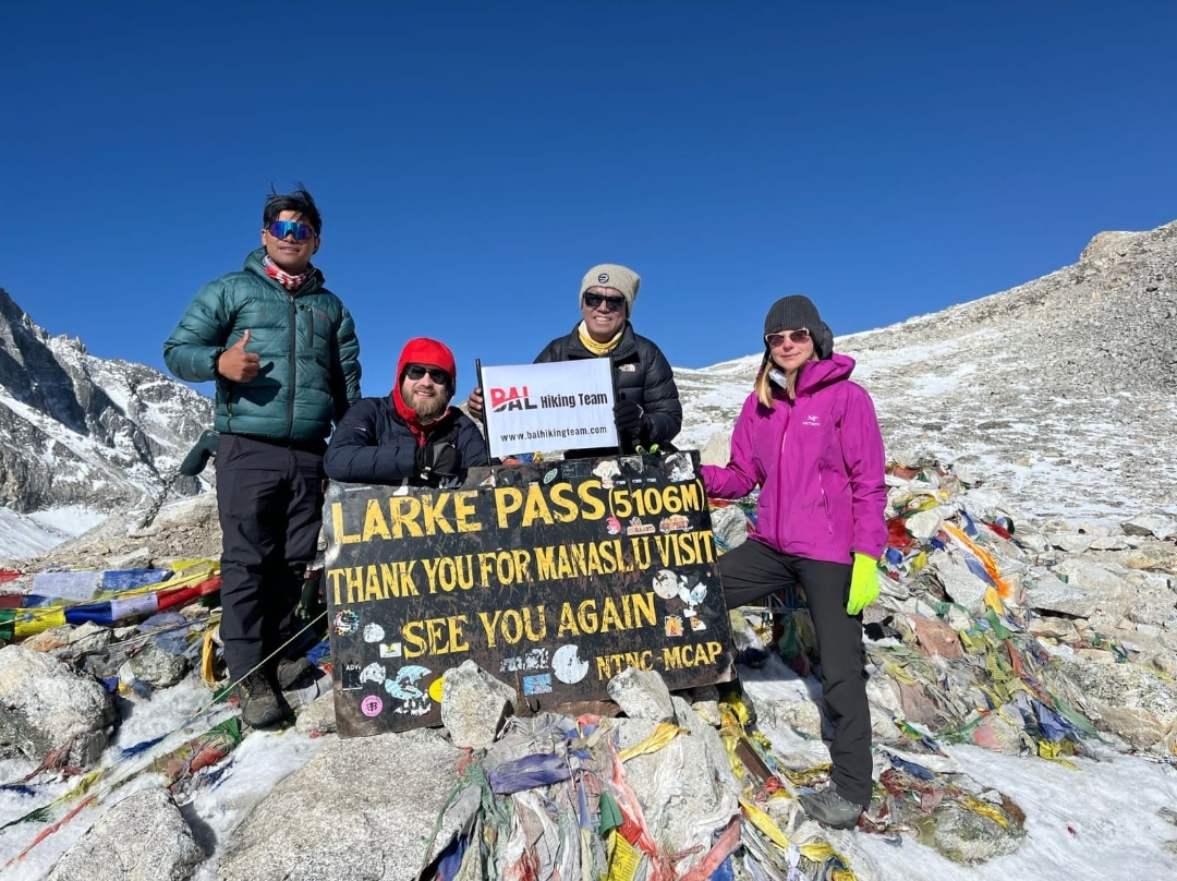
Day 11: Larkya Phedi (4,460 m) → Bimtang (3,720 m) via Larkya La Pass (5,106 m)
-Trekking Time: 9–11 hours (17 km total)
Route:
-Pre-dawn start (~3–4 AM) to ascend ~650 m on scree/snow to the Larkya La Pass (5,106 m).
-Expect 4–5 hours to the pass: innumerable switchbacks; use crampons if needed.
-From the pass, steep descent (rocky, loose terrain) to Bhimtang.
Highlights:
-Larkya La Summit: Unobstructed views of Himal Chuli (7,893 m), Cheo Himal (6,800 m), Ngadi Chu Glacier, and on a clear day, the crest of the Annapurna range far west.
-Glacier-fed streams; alpine meadows on the descent.
-Overnight: Tea-house in Bhimtang (teahouses are basic: cold showers and limited menus, but the scenery is spectacular).
-Meals: B/L/D with Tea and Coffee
Day 12: Bimtang (3,720 m) → Dharapani (1,860 m)
-Trekking Time: 7–8 hours (18 km)
Route:
-Descend through meadows, cross Gudhi Gandaki Valley, passing Himal Chuli Base Camp junction.
-Continue past Tal Village (3,330 m), then through Bagar, crossing suspension bridges over Gandaki River.
-Final descent to Dharapani.
Highlights:
-Views of Himalchuli from the valley floor.
-Oak and pine forests transitioning to warmer, lower elevations.
-Overnight: Lodge in Dharapani.
-Meals: B/L/D with Tea and Coffee
Day 13: Dharapani (1,860 m) → Besisahar (760 m) → Kathmandu (1 350 m)
-Total driving distance: ~229 km
-Dharapani → Besisahar: ≈ 53 km
-Besisahar → Kathmandu (via Prithvi Highway): ≈ 176 km
-Total ≥ drive time: ~10–12 hours (including breaks)
-Meals: B/L/D with Tea and Coffee
-Hotel: No
-Meals: B/L with Tea and Coffee
Note: Extend your days as per your need in Kathmand and on your departure to Airport, Bal Hiking Team will drop you by Private Transport.
Preparations & Permits
- Trekking Permits
- Manaslu Restricted Area Permit (RAP): USD 100 per week, additional USD 15 for each extra day.
- Annapurna Conservation Area Permit (ACAP): NPR 3,000 (approx. USD 25).
- Manaslu Conservation Area Permit (ACAP): NPR 3,000 (approx. USD 25).
- Tsum Nubri Municipality areas Permit : NPR 1,000 (approx. USD 10).
- Best Season
- Autumn (mid-Sept to Nov): Generally dry, stable weather, clear mountain views.
- Spring (March to May): Moderate weather, rhododendron blossoms.
- Fitness & Acclimatization
- Prior mountain/hiking experience is strongly recommended.
- Allow 1–2 days in Samagaon (3,530 m) for acclimatization if possible.
- Carry layers: base layer, fleece, down jacket; nights can drop to –10 °C around Larkya La.
- Luggage Transfer & Tea-House Stays
- Most trekkers use tea-houses/lodges each night: dorm-style or twin sharing, with basic food (dal‑bhat, soups, noodles).
- Porters can carry heavy bags; you typically carry a daypack (4–6 kg).
Optional Extensions & Side‑Trips
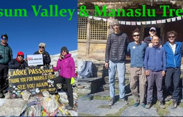
- Tsum Valley Extension (adds 7 days):
- From Jagat, take side trail → Philim → Chumling → Chhokang Paro → Mu Gompa (trekking through Tsum Valley).
- Rejoin main Manaslu trail at Dharche or Benglung.
- Requires additional Tsum Restricted Area Permit.
- Tilicho Lake Detour (adds ~2 days):
- From Chame, trek north to Khangsar, then east over Mange La Pass into Tilicho Lake (4,919 m).
- Return to Pisang/Manang and descend.
Key Highlights & Cultural Notes
- Larkya La Pass (5,106 m): Most challenging section; route often snow-bound until late October.
- Samdo Village (3,860 m): Last “Nepalese” village—beyond lies Tibetan plateau landscape.
- Monasteries & Gompas: Lho Gompa, Ribung Gompa, Pungyen Ling, and many mani walls/prayer flags in each settlement.
- Local Ethnicity: Dominated by Gurung, Tibetan, and Thakuri communities—rich Buddhist/Tibetan cultural influence.
- Flora & Fauna: At lower elevations: rhododendron, bamboo, oak forests. Above 3,500 m: alpine meadows, juniper. Possible sightings of Himalayan Thar, musk deer, snow leopards (rare).
Accommodation & Food
- Tea-House Standard: Most villages offer basic twin/dorm rooms with shared bathrooms. Expect
- Samagaon/Samdo: Slightly more basic—no showers, squat toilets.
- Bimtang/High Camps: Floor mats; sometimes no firewood—bring a good down bag rated for –15 °C.
- Meals:
- Dal Bhat (rice and lentils): Standard every meal; unlimited refills.
- Momos, noodle soups, omelettes, and tsampa (barley flour) at higher elevations.
- Cost estimates: Dal Bhat NPR 700–900 (USD 7–9) at lower elevations; NPR 900–1200 (USD 9–2) above 3,000 m.
Practical Tips
- Daily Distances & Hours
- Average 4–8 hours of trekking each day.
- Early starts (6–7 AM) help avoid afternoon weather in high passes.
- Water & Hydration
- Boiled/filter-purified water available: NPR 150–300 per liter above Namrung.
- Carry a Steripen/UV-filter or purification tablets to refill in streams.
- Packing
- Essentials: Down jacket, warm hat, gloves, base layers, fleece jacket, waterproof outer shell, sturdy trekking boots, gaiters.
- Accessories: Sunglasses (UV 400), sunscreen (SPF 50+), water bottle (1 L), headlamp with spare batteries, trekking poles.
- Altitude Sickness
- Listen to your body. If headache, nausea, dizziness: descend at least 300 m.
- Consider carrying Acetazolamide (Diamox) after consulting a physician.
- Main Trekking Gear
-
- Backpack (35–45 L daypack)
- Should be comfortable, adjustable to your torso length, with padded shoulder straps and hip belt.
- Rain cover (often built‐in or bought separately).
- Capacity for all daily essentials (water, camera, rain gear, snacks, extra layers).
- Duffel Bag / Large Gear Bag
- Used to store/transport gear that you won’t carry on trekking days—sleeping bag, extra clothes, down jacket, etc.
- Most trekking agencies in Nepal include porter service, so you can pack this in a 60–70 L duffel/sack.
- Sleeping Bag
- Temperature rating: At least –10 °C (–15 °C comfort rating).
- Fit: Mummy‐style with a snug hood.
- Fill type: Down is lighter and more compressible; synthetic is ok if you’re prone to damp.
- Sleeping Pad (optional but highly recommended)
- A lightweight insulated foam or inflatable pad to insulate you from the cold ground.
- R‐value ≥2.5 (for 4 season use) is ideal if you plan to camp above 4,000 m.
- If staying in teahouses (most do), you can often rent pads locally—but supply may be limited or uneven quality.
- Trekking Poles
-
- Adjustable (usually 60–135 cm range), preferably with a sturdy locking mechanism (FlickLock or similar).
- Tips: You can swap to rubber baskets near villages; keep snow baskets for the Larkya La section if there’s snow.
-
- Backpack (35–45 L daypack)
- Trekking Footwear
- Boots:
- Sturdy, waterproof or highly water‐resistant (Gore‑Tex or equivalent);
- High ankle support (mid‐ to high‐cut);
- Already well‑broken‑in (no new boots the morning you fly to Kathmandu!).
- Camp Shoes / Sandals:
- Lightweight sandals, flip‑flops, or very light slip‑on shoes for evenings in teahouses.
- Helps air out boots and gives your feet a break.
- Boots:
- Gaiters (optional, but recommended if you expect snow or deep mud)
- Low or mid‑height gaiters to keep snow, grit, and mud out of your boots.
- Clothing (Layering System)
For Manaslu, layering is essential. Temperatures vary from warm (daytime in valleys, up to 2,500 m) to very cold (nights in higher villages above 3,500 m, Larkya La early morning). Aim for moisture‐wicking and quick‐dry fabrics.
- Base Layers (next‑to‑skin)
- Long‐sleeve thermal top (merino wool or synthetic)
- Wicks moisture, traps body heat.
- Thermal leggings / bottoms (merino/synthetic)
- Worn at night or when it’s very cold (e.g., crossing Larkya La).
- Short‐sleeve quick‑dry trekking shirts (2–3 pieces)
- Lightweight, breathable; manage perspiration at lower elevations.
- Mid Layers
- Fleece jacket / pullover (200–300 g/m² weight)
- For warmth in evenings and early mornings; also useful above 3,000 m.
- Fleece pants (optional; good for evenings if you’re very cold‐sensitive)
- Light insulated jacket (down or synthetic, 200–300 g fill)
- Useful for chillier mornings on Larkya La and evenings above 3,500 m.
- Can also double as a pillow when stuffed into a stuff sack.
- Outer Layers (Shells)
- Hard Shell Jacket (waterproof & windproof)
- Gore‑Tex or equivalent; taped/sealed seams.
- Hood with adjustable drawstrings that fits over a hat.
- Hardshell Pants
- Waterproof, breathable (Gore‑Tex or PU‑coated).
- Full‑length side zippers for easy ventilation / on‑off without removing boots.
- Trekking Pants / Shorts
- Lightweight trekking pants (1–2 pairs)
- Quick‑dry, convertible zip‑off style (pants ↔ shorts) is ideal.
- Reinforced knees/crotch if you’re prone to slides.
- Softshell pants (optional, but useful above 3,500 m)
- Wind‐resistant, water‐repellent, more insulation than lightweight pants.
- Hiking shorts (optional, if trekking in warmer seasons)
- Only for lower elevations (<2,500 m) or if you tend to overheat.
- Insulated Layers
- Down Jacket (full‐length, hooded, ≥800 fill power)
- Essential above 3,500 m; packable.
- Should be rated to at least –15 °C.
- Down Pants / Synthetic Insulated Pants (optional, but helpful if you get cold easily)
- To wear around camp or early mornings crossing the pass.
- Accessories
- Warm Hat / Beanie (fleece or wool)
- Balaclava / Neck Gaiter / Buff
- Protects against wind, sun, and cold at higher elevations.
- Sun Hat / Baseball Cap (for sun protection at lower altitudes)
- Sunglasses (UV‑protected; glacier‐rated if you expect snow)
- Category 3 or 4 lenses recommended above 4,000 m.
- Gloves / Mittens
- Inner glove (lightweight liner): Merino or polypropylene.
- Outer glove (insulated and waterproof): Down or synthetic fill, with a waterproof shell.
- Glove/mitten liners help with dexterity when taking photos or adjusting zippers.
- Socks
- Trekking socks (3–4 pairs): Merino wool or synthetic, mid‑weight.
- Liner socks (optional): Thin, to reduce blisters.
- Camp socks: Warm, thick wool socks to wear around teahouses.
- Underwear / Sports Bras (enough for 7–8 days; plan to hand‑wash)
- Buff / Bandana (multi‑use for sweat, sun, dust).
3. Technical & Safety Gear
- Headlamp
- LEDs with adjustable brightness; bring extra batteries.
- Use for early‐morning starts (e.g., Larkya La crossing) and late‐night movements (restrooms).
- Water Purification
- Water filter (e.g., Sawyer Mini or Katadyn), or
- Water purification tablets (e.g., Aquatabs, chlorine dioxide).
- Boiling is also possible in teahouses but requires time/fuel.
- Hydration System
- Water bottles (2× 1 L): BPA‑free, durable.
- Insulated water bladder (2 L) with tube cover to prevent freezing (if using above 4,000 m).
- Sunglasses / Glacier Goggles
- Category 4 glacier glasses if you expect snowfields; category 3 is minimum for high‐altitude trekking.
- Side shields help block wind and intense reflected sunlight.
- Crampons / Microspikes (Seasonal)
- Late autumn or early spring can have snow/ice on Larkya La.
- If trekking October/April, carry lightweight crampons (8–10 points) or microspikes.
- Ensure your boots are crampon‑compatible.
- Ice Axe (Optional/Seasonal)
- For self‑arrest on icy/snowy slopes—only if you expect significant snow accumulation.
- Many trekkers rely on local guides/porters instead; if you don’t know how to self‑arrest, a pole + microspikes may suffice.
- Trekking Poles
- Already mentioned above, but essential—reduces impact on knees and helps balance on uneven/icy terrain.
- Personal First Aid Kit (see below under “Medications & First Aid”).
- Personal & Comfort Items
- Trekking Towel
- Lightweight, quick‑dry microfiber towel.
- Toiletries
- Biodegradable soap (for body/hair), toothbrush & toothpaste, quick‑dry travel towel, wet wipes (limited water in teahouses).
- Hand sanitizer (small bottle).
- Toilet Paper / Tissue Packs
- Most teahouse toilets run out quickly or charge extra.
- Lip Balm (SPF 30+)
- High‐altitude sun and wind can chap lips severely.
- Sunscreen (SPF 50+)
- Broad‑spectrum (face and body; small tube).
- Moisturizer / Small Tube of Hand Cream
- Prevents dry/cracked skin in cold, windy weather.
- Quick‐Dry Underwear
- Helps with limited drying opportunities; bring 4–5 pairs.
- Small Mirror (optional)
- Useful for personal care, shaving, etc.
- Earplugs & Eye Mask (optional)
- Teahouse rooms are often small, shared, and can have varied noise levels/lighting.
- Journal & Pen (optional)
- To record daily impressions, high‐altitude reflections.
- Electronics & Documentation
- Camera / GoPro / Smartphone
- Spare batteries (batteries drain quickly in cold/high altitude—carry in inner pockets to keep them warm).
- Extra memory cards.
- Power Bank (10,000 mAh or higher)
- Charging in teahouses can be inconsistent or costly (usually USD 1–2 per charge).
- Carry a high‐capacity, reliable power bank; ideally with multiple USB outputs.
- Chargers & Adapters
- Nepal uses Type C, D, and M sockets; bring a universal adapter.
- Extra USB cables.
- Headphone / Earbuds (optional, for music/offline audiobooks in teahouses).
- Travel Documents (keep copies in waterproof sleeve or ziplock):
- Passport + Visa (or visa‑on‑arrival slip).
- Permits:
- Manaslu Restricted Area Permit (RAP).
- Annapurna Conservation Area Permit (ACAP).
- Trekkers’ Information Management System (TIMS) card (must be valid throughout trek).
- Note: Agencies typically handle permit acquisitions; just carry originals + copies in separate ziplocks.
- Travel Insurance (with high‐altitude evacuation coverage; keep printed and digital copy).
- Emergency Contact Info (printed card with guide’s number, agency phone, insurance hotline).
- Wallet / Money Belt
- Small money belt worn under clothes is safer—carry cash (USD, euro, or NPR) for teahouse meals, tips, snacks.
- Credit/debit cards are only useful in Kathmandu or major towns; no ATMs on the trek itself.
- Health, Hygiene & First Aid
- Personal First Aid Kit (compact, in water‑resistant pouch)
- Blister care: Moleskin, blister pads (e.g., Compeed).
- Band‐Aids: Various sizes of sterile adhesive dressings.
- Antiseptic wipes / antiseptic solution (e.g., Betadine or alcohol wipes).
- Gauze pads and medical tape.
- Tweezers / small scissors (for splinters, tape cutting).
- Pain relievers: Ibuprofen or paracetamol.
- Anti‑diarrheal: Loperamide, Pepto‑Bismol tablets.
- Oral rehydration salts (ORS) or electrolyte powder (for dehydration/diarrhea).
- Altitude sickness medication:
- Acetazolamide (Diamox): Only if prescribed by a physician—start 1 day prior to ascent.
- Dexamethasone: Only with medical advice.
- Altitude sickness oxygen (capsules or small canister): Optional; some guides carry portable oxygen.
- Personal prescription meds (if any).
- Antibiotics (e.g., Azithromycin or Ciprofloxacin)—only if prescribed.
- Antihistamines (for allergies).
- Sunburn relief: Aloe vera gel, cooling gel.
- Hand Sanitizer & Wet Wipes (for limited water situations).
- Toothbrush & Toothpaste, small travel‐size.
- Quick‐Dry Travel Towel (microfiber).
- Optional / “Nice‑to‑Have” Items
- Satellite Phone / SPOT Tracker / Garmin InReach (for true backcountry security)
- Most teams hire a local guide with VHF/handheld radio; consider an SOS device if traveling independently.
- Lightweight Camp Chair or Sit Pad (foil emergency blanket type)
- Teahouse benches are sometimes cold or wet.
- Entertainment
- Book / Kindle (if you read a lot; load ebooks before leaving Kathmandu).
- Cards / Compact travel games (for evenings).
- Snacks
- Energy bars, gels, trail mix, chocolate, dried fruit.
- Available along the trek, but costlier at higher villages.
- Small Sewing Kit (needle, thread, safety pins).
- Camera Tripod (mini/travel tripod if you do time‑lapses or group photos).
- Portable Water Filter Straw (e.g., LifeStraw) for quick sips when traversing streams.
- Packing Tips & Weight Management
- Total Pack Weight:
- Aim for ~10–12 kg (22–26 lbs) for your daypack (including water, snacks, camera, extra layers).
- The duffel/gear bag weight (sleeping bag, down jacket, extra clothing) carried by porter can be up to 20–25 kg (per porter limits).
- Layer Strategically:
- As you ascend, temperatures drop ~6 °C per 1,000 m—pack enough insulating layers but plan to peel off at lower elevations.
- Dry Bags / Ziplock Bags:
- Keep electronics, documents, and spare clothes in dry bags or heavy‐duty ziplocks to protect from rain and dust.
- Pack by Category:
- Pack sleeping bag + down jacket at bottom of duffel, then clothes; keep daypack items (rain gear, water, camera) easily accessible.
- Test Backpack Fit in Kathmandu:
- Before departing for Soti Khola (trek’s trailhead), fill your daypack and walk around the hotel/Thamel area to ensure comfort.
- Seasonal Considerations
- Autumn (Sept–Oct):
- Generally stable weather, crisp days, clear views.
- Nights: –5 °C to –10 °C above 3,000 m.
- Minimal snow on Larkya La, but unexpected snowfall can occur in late October.
- Crampons/microspikes recommended only if forecasts show snow.
- Spring (Mar–Apr):
- Cold nights (–10 °C to –15 °C above 3,500 m).
- Chances of snow and ice on Larkya La; bring crampons and know how to self‑arrest.
- Early in season (March), snow bridges might still exist; check current conditions.
- Winter (Nov–Feb):
- Most teahouses closed; extreme cold (–20 °C at night); hazardous conditions—only for experienced, well‑equipped adventurers.
- Monsoon (Jun–Aug):
- Trail becomes muddy, slippery; leeches; frequent landslides. Not recommended.
- Final Checklist (Quick Reference)
| Category | Essential Items |
| Backpack & Bags | 35–45 L daypack + rain cover; 60–70 L duffel for porter |
| Sleep System | –10 °C-rated sleeping bag; sleeping pad (R‑value ≥ 2.5) |
| Footwear | Waterproof hiking boots (high ankle); camp shoes/sandals; gaiters (optional) |
| Clothing Base Layers | 2 × thermal tops (long‐sleeve); 2 × thermal bottoms; 2–3× quick‑dry T‑shirts |
| Mid Layers | 1× fleece jacket; (optional fleece pants); 1× light insulated jacket |
| Outer Layers | 1× hard shell jacket (waterproof/windproof); 1× hard shell pants |
| Bottoms | 1–2× trekking pants (preferably convertible); (optional softshell pants) |
| Insulation | 1× down jacket (≥ 800 fill); (optional down pants) |
| Accessories | Warm hat/beanie; balaclava/buff; sun hat; sunglasses (Cat 3‑4); gloves: liner + insulated shell; 4–5× trekking socks; liner socks (optional) |
| Hydration & Purify | 2 × 1 L water bottles; 2 L bladder (insulated cover); water filter or purification tablets |
| Trekking Poles | Adjustable poles (tips + baskets) |
| Crampons / Ice Gear | Microspikes or 8–10 point crampons (if snow/ice expected); ice axe (only if you know how to use) |
| Headlamp | LED headlamp + spare batteries |
| Electronics | Camera + batteries; smartphone; power bank (≥ 10,000 mAh); chargers + universal adapter; headphones (optional) |
| Documents | Passport + visa; Manaslu RAP; ACAP; TIMS card; travel insurance; emergency contacts |
| First Aid & Meds | Blister kit (moleskin, Compeed); basic bandages; antiseptic; painkillers; anti‑diarrheal; ORS; altitude meds (Acetazolamide, as prescribed); personal meds |
| Personal Items | Toothbrush/paste; biodegradable soap; travel towel; wipes; hand sanitizer; lip balm (SPF 30+); sunscreen (SPF 50+); toiletries |
| Optional Extras | Satellite/SOS device; sleeping pad (if renting is insufficient); snacks; book/Kindle; small games; camera tripod; camp chair |
Tips & Reminders
- Layering Is Key: Temperatures can swing from 5 °C in lower valleys (daytime) to –20 °C at night above 4,000 m. Use your layers smartly—shed layers when you heat up during ascents, add layers when resting or in camps.
- Water Management: Drink at least 3–4 L per day at higher elevations to prevent dehydration. Purify all water.
- Altitude Awareness: Ascend slowly, drink lots of fluids, and know early symptoms of Acute Mountain Sickness (headache, nausea, dizziness). If symptoms worsen, do not hesitate to descend.
- Electronics in Cold: Keep batteries in inner pockets close to body heat; cold drains battery life rapidly.
- Pack Light: Every extra kilogram makes a difference—evaluate each item’s necessity carefully.
- Fix It Kits: Bring duct tape or rolling bandages (small roll) to mend torn gear or patch blisters.
- Re‐use & Re‐Hydrate: Most teahouses boil water; carry a reusable water bottle to reduce plastic waste.
- Laundry: All teahouses offer laundry for USD 1–2/kg, but drying conditions can be slow—pack enough socks/underwear for at least a week to limit laundry.
Planning Your Meals on the Manaslu Circuit Trek
When trekking the Manaslu Circuit, you’ll rely almost entirely on teahouse (lodge) kitchens for breakfast, lunch, dinner, and snacks. Below is a breakdown of what to expect in terms of meal availability, typical menus, cost ranges (in USD), and tips to stay well‐nourished at altitude.
- Typical Meal Structure
- Breakfast (usually served 6:30 AM–8:00 AM)
- Porridge (oatmeal, corn, or buckwheat)
- Eggs (omelet or scrambled)
- Toast or Tibetan bread (tsampa bread)
- Pancakes (sometimes with honey or jam)
- Cornflakes or muesli (with powdered milk)
- Tea/coffee (milk tea, black tea, instant coffee)
- Lunch (usually from 11:00 AM–1:00 PM)
- Soups (vegetable, chicken noodle, thukpa [noodle soup], or lentil soup)
- Noodles (plain noodles, chowmein, fried noodles with vegetables or egg)
- Rice dishes (fried rice with veggies/egg, khana set [rice with curry])
- Momos (steamed or fried dumplings with meat/vegetable filling)
- Dal Bhat set (rice with lentil soup, a small curry, and a vegetable side—often considered the “classic” Nepali meal)
- Afternoon Tea/Snacks (around 3:00 PM–4:00 PM)
- Tea/coffee (often with biscuits or packaged cookies)
- Samosas (deep‐fried pastry filled with spiced potato or veg)
- Pakoras (vegetable fritters)
- Instant noodles (2-minute noodles, especially at very high altitude where kitchens keep it stocked)
- Dinner (usually from 6:00 PM–8:00 PM)
- Loaded Dal Bhat (with extra servings of rice, dal, and curry)
- Thukpa or noodle soup (hearty at higher camps)
- Pasta with tomato sauce (sometimes available, though ingredients are basic)
- Veg/Chicken Curry with rice or roti (Nepali roti or Tibetan bread)
- Limited vegetarian “Italian” options (garlic bread, macaroni, etc., in some larger lodges)
- Common Dishes & Dietary Notes
- Dal Bhat (Lentil Rice):
- Staple of Nepali trekking. One “set” usually includes: steamed rice, lentil soup (dal), one or two vegetable curries, pickles (achar), and sometimes a small portion of meat curry (if ordered).
- Most kitchens offer unlimited “refills” of dal and rice, making it a cost‐effective, calorie‐dense choice—especially important as you climb above 3,500 m. - Thukpa & Soups:
- At higher elevations (above 4,000 m), kitchens often close by 7 PM, and crew may offer only noodle soups or porridge. Always confirm the last order time.
- Soups warm you from the inside and are easier to digest when appetite is reduced by altitude. - Momos:
- Available everywhere, but fillings are basic (usually cabbage or potato–vegetable). Meat momos depend on availability and can be expensive (slightly north of USD 5 at higher villages).
- Vegetarian momos with cheese (yak cheese) become more common as you approach Sama Gaun and Larkya La passes. - Snacks (Biscuits, Chocolates, Energy Bars):
- Pack several high‐calorie bars (250–300 kcal each) from Kathmandu (Clif Bars, Trekking Bars). In the villages, packaged “Wai Wai” instant noodles and basic chocolate or biscuits are available but get pricier the higher you go.
- Energy gels or electrolyte tablets can be helpful, but are rarely stocked along the route. Bring your own supply if you rely on them.
Detail Itenerary
-
Manaslu Circuit Trek Itinerary Details
Manaslu Circuit Trek Itinerary 13 days
Day 1: Arrival in Kathmandu (1,350 m)Activities:
Arrive at Tribhuvan International Airport (TIA).
Drive to your Hotel, Bal Hiking Team will Pick you.
Secure trekking permits with Bal Hiking Team
Accommodation: Hotel/hostel as per your Choice.
Meals: No
Day 2: Kathmandu → Soti Khola→ Machhakhola (900 m)Transport:
Drive from Kathmandu to Machhakhola (approx. 8–9 hours by jeep/bus, ~170 km; rugged mountain roads).
Highlights:
Cross Budi Gandaki River by motorable bridges; first taste of Himalayan foothills.
Note: Road conditions can cause delays; start early (~6 AM).
Gorges, waterfalls along riverbanks, glimpses of Manaslu’s southern flanks.
Overnight: Tea-house at Machha Khola.
Meals: B/L/D with Tea and Coffee
Day 3: Machha Khola (900 m) → Jagat (1,300 m)Trekking Time: 6–7 hours (17 km)
Route:
Climb out of Machha Khola through terraced fields, small suspension bridges.
Pass through Chisapani (1,150 m) and Tatopani (hot springs village at ~1,200 m).
Final descent into Jagat, last checkpoint before entering Manaslu Conservation Area.
Highlights:
Jagat Viewpoint: 360° views of surrounding ridges.
Local Gurung settlements.
Overnight: Guesthouse in Jagat.
Meals: B/L/D with Tea and Coffee
Day 4: Jagat (1,300 m) → Deng (1,860 m)Trekking Time: 6–7 hours (15 km)
Route:
Enter Manaslu Conservation Area; required permit checks at Jagat.
Crossing Sangya Khola and Ghatta Khola via multiple suspension bridges.
Pass through small hamlets: Sirdibas, soon reaching Deng.
Highlights:
Dense forest (oak, rhododendron), waterfalls.
Scenic gorge, possibility to see Himalayan Thar.
Overnight: Tea-house in Deng.
Meals: B/L/D with Tea and Coffee
Day 5: Deng (1,860 m) → Namrung (2,630 m)Trekking Time: 6–7 hours (13 km)
Route:
Steep climb out of Deng; forest transitions from subtropical to temperate.
Cross Namrung Khola, pass through bamboo groves, then cross a small waterfall.
Arrive at Namrung, a Tibetan-influenced village at a flatter shelf.
Highlights:
First wide views of Manaslu’s south face.
Mani walls, prayer flags at village outskirts.
Overnight: Lodge in Namrung.
Meals: B/L/D with Tea and Coffee
Day 6: Namrung (2,630 m) → Lho (3,180 m)Trekking Time: 5–6 hours (11 km)
Route:
Climb gradually through alpine pastures; cross streams via logs/bridges.
Pass through Samagaon Valley on opposite side; continue north to Lho.
Highlights:
Lho Monastery: Historic gompa (built 1760 AD), murals.
Panoramic views of Manaslu (8,163 m), Ngadi Chuli (7,871 m).
Overnight: Guesthouse in Lho.
Meals: B/L/D with Tea and Coffee
Day 7: Lho (3,180 m) → Samagaon (3,530 m)Trekking Time: 4–5 hours (8 km)
Route:
Easy uphill through grazing lands; only one short descent into glacial moraine before Samagaon.
Arrive early, allowing half-day acclimatization.
Highlights:
Pungen (Birendra Tal) Lake (4,370 m) day‑hike option; 3–4 hours round trip.
Manaslu Base Camp Viewpoint (5–6 hours round trip): 4,100 m, superb 360° panorama of surrounding peaks.
Overnight: Lodge in Samagaon.
Meals: B/L/D with Tea and Coffee
Day 8: Acclimatization Day at Samagaon (3,530 m)Activities:
Pungen Tsho trek: Follow glacial streams to a small lake, surrounded by 6,000–7,000 m peaks.
Alternatively, a short hike to Ribung Gompa (~1 hour) to see Tibetan-influenced monastery and giant prayer wheel.
Purpose:
Aid acclimatization before crossing Larkya La Pass (5,106 m).
Overnight: Same lodge in Samagaon.
Meals: B/L/D with Tea and Coffee
Day 9: Samagaon (3,530 m) → Samdo (3,860 m)Trekking Time: 4–5 hours (8 km)
Route:
Gentle uphill through glacial moraines and pasturelands.
Reach Samdo, last Nepali village before Tibetan border; many trekkers spend an extra night here if needed.
Highlights:
Samdo Glacier: to the east, massive ice.
Stone‑walled fields, yak pastures.
Overnight: Lodge in Samdo.
Meals: B/L/D with Tea and Coffee
Day 10: Samdo (3,860 m) → Dharmasala / Larkya Phedi (4,460 m)Trekking Time: 5–6 hours (9 km)
Route:
Initially gentle, then steep climb along moraine slopes.
Trail narrows across loose moraine; occasionally snow-covered (especially post‑October).
Arrive at Larkya Phedi or rudimentary shelters (“Dharmasala”), where tea-houses are very basic—some only have mats on the floor. Drink plenty of liquids.
Highlights:
Dramatic glacier views from Larkya Phedi.
Establish last water source before the pass.
Overnight: Basic tea-house or tented lodge at Larkya Phedi (often ≤4 °C at night).
Meals: B/L/D with Tea and Coffee
Day 11: Larkya Phedi (4,460 m) → Bimtang (3,720 m) via Larkya La Pass (5,106 m)Trekking Time: 9–11 hours (17 km total)
Route:
Pre-dawn start (~3–4 AM) to ascend ~650 m on scree/snow to the Larkya La Pass (5,106 m).
Expect 4–5 hours to the pass: innumerable switchbacks; use crampons if needed.
From the pass, steep descent (rocky, loose terrain) to Bhimtang.
Highlights:
Larkya La Summit: Unobstructed views of Himal Chuli (7,893 m), Cheo Himal (6,800 m), Ngadi Chu Glacier, and on a clear day, the crest of the Annapurna range far west.
Glacier-fed streams; alpine meadows on the descent.
Overnight: Tea-house in Bimtang (teahouses are basic: cold showers and limited menus, but the scenery is spectacular).
Meals: B/L/D with Tea and Coffee
Day 12: Bimtang (3,720 m) → Dharapani (1,860 m)Trekking Time: 7–8 hours (18 km)
Route:
Descend through meadows, cross Gudhi Gandaki Valley, passing Himal Chuli Base Camp junction.
Continue past Tal Village (3,330 m), then through Bagar, crossing suspension bridges over Gandaki River.
Final descent to Dharapani.
Highlights:
Views of Himalchuli from the valley floor.
Oak and pine forests transitioning to warmer, lower elevations.
Overnight: Lodge in Dharapani.
Meals: B/L/D with Tea and Coffee
Day 13: Dharapani (1,860 m) → Besisahar (760 m) → Kathmandu (1 350 m)Total driving distance: ~229 km
Dharapani → Besisahar: ≈ 53 km
Besisahar → Kathmandu (via Prithvi Highway): ≈ 176 km
Total ≥ drive time: ~10–12 hours (including breaks)
Meals: B/L/D with Tea and Coffee
Hotel: No
Meals: B/L with Tea and Coffee
Note: Extend your days as per your need in Kathmand and on your departure to Airport, Bal Hiking Team will drop you by Private Transport.
Array
Included in the Cost
We have six different package here,
Manaslu Circuit Trek food Package without porter Cost
Option: 01 ( minimum 2 pax)
Standard 12-Days Package Cost:$ 850 per person with Local Transport (Ktm to Machhakhola)
Note: Dharapani-Besisahar-Ktm will be Public Transportation, if you need Private Tourist Vehicle we provide but cost will be added.
Cost Includes Package :
Airport Pickup and Drop, All the Transportation accommodation during the trek,
full board meals, breakfast , lunch, dinner during the treks
All necessary permits MCP, ACP, special permits Manaslu cricuit trek,
one English speaking Government certificate holder trekking guide
Fingertip pulse oximeter (we use every day to check your oxygen level and pulse in your body to avoid high risk.)
Guide : food, lodge, transportation, salary, insurance, equipment etc.
13% Government Vat and official expenses.
Best available Room and Lodge during the treks.
Mocker spike for the ice when you going to over the Larkey pass to use for the Shoes.
Bal Hiking Team provide Duffel Bag packing your equipment during the treks
Seeping bag down Jacket for use during the treks , after you will be refund for Agency ( if you requirement)
Trekking Certificates, Staffs first aid kid, for high passes mini crampons,
Seasonal fresh fruits .
From kathamandu to Machhakhola by Public Bus
Tillche or Darapani to Besishar sharing Jeep and Public Bus by kathamandu
Excludes Package :
Coke ,fanta, beer , tea ,coffee Whiskey , better changing , wifi, hot shower, water ect.
Two trekkers between one porter they will carry around 2o to 25 kg) $ 240
kathamandu to Machakhola prive jeep $ 235 and Darapani to kathamandu $200
You trekking gears Helicopter, Trekking Equipment
International flights,
Hotel in Kathmandu,Nepal visa, Travel insurance,
Guide /Porter trekking staff Tips personal expenses.
Manaslu Circuit Trek food Package Cost
Optiona : 2
Standard 12-Days Package Cost: $1145 per person with Private Transport (Ktm to Machhakhola)
Standard 12-Days Package Cost:$ 1045 per person with Local Transport (Ktm to Machhakhola)
Note: Dharapani-Besisahar-Ktm will be Public Transportation, if you need Private Tourist Vehicle we provide but cost will be added.
Cost Includes Package :
Airport Pickup and Drop, All the Transportation accommodation during the trek,
full board meals, breakfast , lunch, dinner ,Tea, Coffee, during the treks
All necessary permits MCP, ACP, special permits Manaslu Cricuit trek,
one English speaking Government certificate holder trekking guide
Two trekkers between one porter they will carry around 2o to 25 kg)
Fingertip pulse oximeter (we use every day to check your oxygen level and pulse in your body to avoid high risk.)
Guide and porter: food, lodge, transportation, salary, insurance, equipment etc.
13% Government Vat and official expenses.
Best available Room and Lodge during the treks.
Mocker spike for the ice when you going to over the Larkey pass to use for the Shoes.
Bal Hiking Team provide Duffel Bag packing your equipment during the treks
Seeping bag down Jacket for use during the treks , after you will be refund for Agency ( if you requirement)
Trekking Certificates, Staffs first aid kid, for high passes mini crampons,
Seasonal fresh fruits and Biscuits etc.
From kathamandu to Machhakhola by provide jeep or Public Bus.
Tillche or Darapani to Besishar sharing Jeep and Car or Public Bus by kathamandu.
Excludes Package :
Coke , Fanta, beer , Whiskey , better changing , wifi, hot shower, water ect.
. You trekking gears Helicopter, Trekking Equipment
International flights,
Hotel in Kathmandu,Nepal visa, Travel insurance,
Guide /Porter trekking staff Tips personal expenses.
Manaslu Circuit Trek Package without tea Cost
Option: 03
Standard 12-Days Package Cost: $1085 per person with Private Transport (Ktm to Machhakhola)
Standard 12-Days Package Cost:$ 980 per person with Local Transport (Ktm to Machhakhola)
Note: Dharapani-Besisahar-Ktm will be Public Transportation, if you need Private Tourist Vehicle we provide but cost will be added.
Cost Includes Package :
Airport Pickup and Drop, All the Transportation accommodation during the trek,
full board meals, breakfast , lunch, dinner , during the treks
All necessary permits MCP, ACP, special permits Manaslu cricuit trek,
one English speaking Government certificate holder trekking guide
Two trekkers between one porter they will carry around 2o to 25 kg)
Fingertip pulse oximeter (we use every day to check your oxygen level and pulse in your body to avoid high risk.)
Guide and porter: food, lodge, transportation, salary, insurance, equipment etc.
13% Government Vat and official expenses.
Best available Room and Lodge during the treks.
Mocker spike for the ice when you going to over the Larkey pass to use for the Shoes.
Bal Hiking Team provide Duffel Bag packing your equipment during the treks
Seeping bag down Jacket for use during the treks , after you will be refund for Agency ( if you requirement)
Trekking Certificates, Staffs first aid kid, for high passes mini crampons,
Seasonal fresh fruits ,
From kathamandu to Machhakhola by provide car or jeep Public Bus
Tillche or Darapani to Besishar sharing Jeep and Car Public Bus by kathamandu
Excludes Package :
Coke ,fanta, beer , Whiskey , better changing , wifi, hot shower, water ect.
You trekking gears Helicopter, Trekking Equipment
International flights, tea coffee during the treks.
Hotel in Kathmandu,Nepal visa, Travel insurance,
Guide /Porter trekking staff Tips personal expenses.
Manaslu Circuit Trek B&B Package Cost
Option: 04
Standard 12-Days Package Cost: $ 905 per person with Private Transport (Ktm to Machhakhola)
Standard 12-Days Package Cost:$ 803 per person with Local Transport (Ktm to Machhakhola)
Note: Dharapani-Besisahar-Ktm will be Public Transportation, if you need Private Tourist Vehicle we provide but cost will be added.
Cost Includes Package :
Airport Pickup and Drop, All the Transportation accommodation during the trek,
breakfast with Tea, Coffee, (B&B with Room) during the treks
All necessary permits MCP, ACP, special permits Manaslu cricuit trek,
one English speaking Government certificate holder trekking guide
Two trekkers between one porter they will carry around 2o to 25 kg)
Fingertip pulse oximeter (we use every day to check your oxygen level and pulse in your body to avoid high risk.)
Guide and porter: food, lodge, transportation, salary, insurance, equipment etc.
13% Government Vat and official expenses.
Best available Room and Lodge during the treks.
Mocker spike for the ice when you going to over the Larkey pass to use for the Shoes.
Bal Hiking Team provide Duffel Bag packing your equipment during the treks
Seeping bag down Jacket for use during the treks , after you will be refund for Agency ( if you requirement)
Trekking Certificates, Staffs first aid kid, for high passes mini crampons,
Seasonal fresh fruits,
From kathamandu to Machhakhola by provide car or jeep Public Bus
Tillche or Darapani to Besishar sharing Jeep and Car Public Bus by kathamandu
Excludes Package :
full board meals, breakfast , lunch, dinner ,Tea, Coffee, during the treks
Coke ,nta, beer , Whiskey , better changing , wifi, hot shower, water ect.
You trekking gears Helicopter, Trekking Equipment
International flights,
Hotel in Kathmandu,Nepal visa, Travel insurance,
Guide /Porter trekking staff Tips personal expenses.
Manaslu Circuit Trek Rooms Package Cost
Option 05
Standard 12-Days Package Cost: $ 809 per person with Private Transport (Ktm to Machhakhola)
Standard 12-Days Package Cost:$ 706 per person with Local Transport (Ktm to Machhakhola)
Note: Dharapani-Besisahar-Ktm will be Public Transportation, if you need Private Tourist Vehicle we provide but cost will be added.
Cost Includes Package :
Airport Pickup and Drop, All the Transportation accommodation during the trek,
All necessary permits MCP, ACP, special permits Manaslu cricuit trek,
one English speaking Government certificate holder trekking guide
Two trekkers between one porter they will carry around 2o to 25 kg)
Fingertip pulse oximeter (we use every day to check your oxygen level and pulse in your body to avoid high risk.)
Guide and porter: food, lodge, transportation, salary, insurance, equipment etc.
13% Government Vat and official expenses.
Best available Room and Lodge during the treks.
Mocker spike for the ice when you going to over the Larkey pass to use for the Shoes.
Bal Hiking Team provide Duffel Bag packing your equipment during the treks
Seeping bag down Jacket for use during the treks , after you will be refund for Agency ( if you requirement)
Trekking Certificates, Staffs first aid kid, for high passes mini crampons,
From kathamandu to Machhakhola by provide car or jeep Public Bus
Tillche or Darapani to Besishar sharing Jeep and Car Public Bus by kathamandu
Excludes Package :
full board meals, breakfast , lunch, dinner ,Tea, Coffee, during the treks
Coke ,fanta, beer , Whiskey , better changing , wifi, hot shower, water ect.
You trekking gears Helicopter, Trekking Equipment
International flights,
Hotel in Kathmandu,Nepal visa, Travel insurance,
Guide /Porter trekking staff Tips personal expenses.
Manaslu Circuit Trek Normal Luxury food Package Cost
Option: 06
Standard 12-Days Package Cost: $ 1275 per person with Private Transport (Ktm to Machhakhola)
Note: Dharapani-Besisahar-Ktm will be Public Transportation, if you need Private Tourist Vehicle we provide but cost will be added.
Cost Includes Package :
Airport Pickup and Drop, All the Transportation accommodation during the trek,
full board meals, breakfast , lunch, dinner , soups, dessert , Tea, Coffee, during the treks
All necessary permits MCP, ACP, special permits Manaslu cricuit trek,
one English speaking Government certificate holder trekking guide
Two trekkers between one porter they will carry around 2o to 25 kg)
Fingertip pulse oximeter (we use every day to check your oxygen level and pulse in your body to avoid high risk.)
Guide and porter: food, lodge, transportation, salary, insurance, equipment etc.
13% Government Vat and official expenses.
Best available Room and Lodge during the treks.
Mocker spike for the ice when you going to over the Larkey pass to use for the Shoes.
Bal Hiking Team provide Duffel Bag packing your equipment during the treks
Seeping bag down Jacket for use during the treks , after you will be refund for Agency ( if you requirement)
Trekking Certificates, Staffs first aid kid, for high passes mini crampons,
Seasonal fresh fruits and Biscuits etc.
From kathamandu to Machhakhola by provide car or jeep,
Tillche or Darapani to Besishar sharing Jeep and Car by kathamandu
Excludes Package :
Coke ,fanta, beer , Whiskey , better changing , wifi, hot shower, water ect.
You trekking gears Helicopter, Trekking Equipment
International flights,
Hotel in Kathmandu,Nepal visa, Travel insurance,
Guide /Porter trekking staff Tips personal expenses.
Backpack & Bags:
- 35–45 L day-pack + rain cover; 60–70 L duffel bag for porter
Sleep System
- –10 -20 °C-rated sleeping bag; sleeping pad (R value ≥ 2.5)
Footwear:-
- Waterproof hiking boots ,( waterproof jacket , windproof jacket , rain Jacket dependant of session time) (high ankle); camp shoes/sandals; gaiters (optional)
Clothing Base Layers
- 2 + thermal tops (long‐sleeve); 2 + thermal bottoms; 2–3+ quick dry T shirts
Mid Layers,
- 1 fleece jacket; (optional fleece pants,1 light insulated jacket)
Outer Layers,
- 1 hard shell jacket (windproof); 1 hard shell pants
Bottoms
- 1–2 trekking pants (preferably convertible); (optional soft-shell pants)
Insulation,
- 1 down jacket (≥ 800 fill); (optional down pants)
Accessories,
- Warm hat/beanie; balaclava/buff; sun hat or Cap , sunglasses (Cat 3 4); gloves: liner + insulated shell; 4–5 pairs trekking socks; liner socks (optional)
Hydration & Purify,
- 1-2 L water bottles, 2 L bladder (insulated cover); water filter or purification tablets, metal bottles for keeping warm water .
Trekking Poles,
- Adjustable poles (tips + baskets)
Toiletries & personal care
- Toothbrush, toothpaste, quick-dry towel, biodegradable soap &shampoo, wet wipes, toilet paper , hand sanitizer , sunscreen (SPF 50+) lip balm with SPF, personal hygiene item (female products)
Crampons / Ice Gear,
- Micro spikes or 8–10 point crampons (if snow/ice expected); ice axe (only if you know how to use)
Headlamp,
- LED headlamp + spare batteries
Electronics,
- Camera + batteries; Smartphone; power bank (≥ 10,000 mAh); chargers + universal adapter; headphones (optional)
Documents,
- Passport + visa; Manaslu RAP; ACAP; TIMS card; travel insurance; emergency contacts
First Aid & Meds,
- basic first –aid kid ( bandages, antiseptic, painkillers, blister plasters, ibuprofen , paracetamol, anti diarrheal, ORS, altitude meds (Acetazolamide, as prescribed) personal meds
Personal Items,
- Toothbrush/paste; biodegradable soap; travel towel; wipes; hand sanitizer; lip balm (SPF 30+); sunscreen (SPF 50+); toiletries
Optional Extras,
- Satellite/SOS device; sleeping pad (if renting is insufficient); snacks; book/Kindle; small games; camera tripod; camp chair
1 Reviews on Manaslu Circuit Trek View All
Leave a Reply
-
All Inclusive Price 1145$
-
Duration 14 day $ 706
Customer Review
1 reviews
 Annapurna Base Camp (ABC) Trek
10 days $ 728
 Everest Three Passes Trek
18-19 Day $ 1700
 Everest Base Camp (EBC) Trek
14 Days $ 985
- Location : Manaslu Circuit Trek
- Duration : 14 day $ 706
- Trek Grade : Moderate
- Max Elevation : 5106 m
- Trek Style : Lodge tea house
- Mode of Trek : lodges / Tea house treks
Quick Inquiry
Related Packages
-
Duration:20 Day $1560
Trip Grade: Moderate
Max. Altitude
5106 m
-
Duration:14 day $ 706
Trip Grade: Moderate
Max. Altitude
5106 m
-
Duration:14 Days $ 985
Trip Grade: Moderate
Max. Altitude
5550 m

2025-06-10 16:25:24
ellebeelv says:
Book with this company! Manaslu circuit trek Bal Hiking team is the best. We contacted over 10 company's in our search for a trek. Bal Hiking team was the most responsive and comprehensive in working with prior to our book and beyond. Typically w...